Fleys: Difference between revisions
Appearance
Content deleted Content added
JJMC89 bot (talk | contribs) Migrate {{Infobox French commune}} coordinates parameters to {{Coord}}, see Wikipedia:Coordinates in infoboxes |
|||
| Line 1: | Line 1: | ||
{{Infobox French commune |
{{Infobox French commune |
||
|name = Fleys |
|name = Fleys |
||
| |
|coordinates = {{coord|47.8156|3.8631|format=dms|display=inline,title}} |
||
|longitude = 3.8631 |
|||
|INSEE = 89168 |
|INSEE = 89168 |
||
|postal code = 89800 |
|postal code = 89800 |
||
Revision as of 03:43, 3 February 2017
Fleys | |
|---|---|
| Coordinates: 47°48′56″N 3°51′47″E / 47.8156°N 3.8631°E | |
| Country | France |
| Region | Bourgogne-Franche-Comté |
| Department | Yonne |
| Arrondissement | Avallon |
| Canton | Tonnerre |
| Area 1 | 8.17 km2 (3.15 sq mi) |
| Population (2006) | 177 |
| • Density | 22/km2 (56/sq mi) |
| Time zone | UTC+01:00 (CET) |
| • Summer (DST) | UTC+02:00 (CEST) |
| INSEE/Postal code | 89168 /89800 |
| Elevation | 146–316 m (479–1,037 ft) |
| 1 French Land Register data, which excludes lakes, ponds, glaciers > 1 km2 (0.386 sq mi or 247 acres) and river estuaries. | |
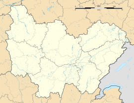
Fleys is a commune in the Yonne department in Bourgogne-Franche-Comté in north-central France.
See also
References
Wikimedia Commons has media related to Fleys.


