Zarzosa: Difference between revisions
Appearance
Content deleted Content added
m Bot: Migrating 1 langlinks, now provided by Wikidata on d:Q1636146 |
No edit summary |
||
| Line 1: | Line 1: | ||
{{Expand Spanish|topic=geo|date=August 2011|Zarzosa}} |
{{Expand Spanish|topic=geo|date=August 2011|Zarzosa}} |
||
{{Infobox settlement |
|||
<!-- See Template:Infobox settlement for additional fields and descriptions --> |
|||
| name = Zarzosa |
|||
| native_name = |
|||
| native_name_lang = <!-- ISO 639-2 code e.g. "fr" for French. If more than one, use {{lang}} instead --> |
|||
| settlement_type = [[Municipalities of Spain|Municipality]] |
|||
| image_skyline = Iglesia_de_Nuestra_Señora_del_Pilar,_Zarzosa.jpg |
|||
| image_alt = |
|||
| image_caption = |
|||
| image_flag = |
|||
| flag_alt = |
|||
| image_seal = |
|||
| seal_alt = |
|||
| image_shield = |
|||
| shield_alt = |
|||
| nickname = |
|||
| motto = |
|||
| image_map = |
|||
| map_alt = |
|||
| pushpin_map = Spain La Rioja#Spain |
|||
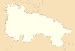
| map_caption = Location of Zarzosa within La Rioja |
|||
| pushpin_label_position = |
|||
| pushpin_map_alt = |
|||
| pushpin_map_caption = |
|||
| coordinates = {{coord|42|10|53|N|2|20|31|W|display=inline,title}} |
|||
| coor_pinpoint = |
|||
| coordinates_footnotes = |
|||
| subdivision_type = [[List of sovereign states|Country]] |
|||
| subdivision_name = {{ESP}} |
|||
| subdivision_type1 = [[Autonomous communities of Spain|Autonomous community]] |
|||
| subdivision_name1 = {{flag|La Rioja (Spain)|name=La Rioja}} |
|||
| subdivision_type2 = [[Comarca]] |
|||
| subdivision_name2 = Arnedo |
|||
| established_title = |
|||
| established_date = |
|||
| founder = |
|||
| seat_type = |
|||
| seat = |
|||
| government_footnotes = |
|||
| leader_party = [[People's Party (Spain)|People's Party]] |
|||
| leader_title = [[Alcalde]] |
|||
| leader_name = José María Sáenz Blanco |
|||
| unit_pref = Metric<!-- or US or UK --> |
|||
| area_footnotes = |
|||
| area_total_km2 = 18.29 |
|||
| area_land_km2 = |
|||
| area_water_km2 = |
|||
| area_water_percent = |
|||
| area_note = |
|||
| elevation_footnotes = |
|||
| elevation_m = 978 |
|||
| population_footnotes = |
|||
| population_total = 14 |
|||
| population_as_of = 2018 |
|||
| population_density_km2 = auto |
|||
| population_demonym = |
|||
| population_note = |
|||
| timezone1 = |
|||
| utc_offset1 = |
|||
| timezone1_DST = |
|||
| utc_offset1_DST = |
|||
| postal_code_type = |
|||
| postal_code = 26586 |
|||
| area_code_type = |
|||
| area_code = |
|||
| iso_code = |
|||
| website = <!-- {{URL|example.com}} --> |
|||
| footnotes = |
|||
}} |
|||
'''Zarzosa''' is a village in the [[province]] and [[autonomous community]] of [[La Rioja (Spain)|La Rioja]], [[Spain]]. The municipality covers an area of {{convert|18.29|km2}} and as of 2011 had a population of 15 people.<ref>{{cite web|url=http://www.ine.es/jaxi/tabla.do?path=/t20/e260/a2011/l0/&file=mun26.px&type=pcaxis&L=0|title=La Rioja: Población por municipios y sexo:Cifras oficiales de población resultantes de la revisión del Padrón municipal a 1 de enero de 2011 |publisher=[[Instituto Nacional de Estadística (Spain)|Instituto Nacional de Estadística]]|accessdate=28 May 2012}}</ref> |
'''Zarzosa''' is a village in the [[province]] and [[autonomous community]] of [[La Rioja (Spain)|La Rioja]], [[Spain]]. The municipality covers an area of {{convert|18.29|km2}} and as of 2011 had a population of 15 people.<ref>{{cite web|url=http://www.ine.es/jaxi/tabla.do?path=/t20/e260/a2011/l0/&file=mun26.px&type=pcaxis&L=0|title=La Rioja: Población por municipios y sexo:Cifras oficiales de población resultantes de la revisión del Padrón municipal a 1 de enero de 2011 |publisher=[[Instituto Nacional de Estadística (Spain)|Instituto Nacional de Estadística]]|accessdate=28 May 2012}}</ref> |
||
Revision as of 21:36, 28 April 2019
You can help expand this article with text translated from the corresponding article in Spanish. (August 2011) Click [show] for important translation instructions.
|
Zarzosa | |
|---|---|
 | |
| Coordinates: 42°10′53″N 2°20′31″W / 42.18139°N 2.34194°W | |
| Country | |
| Autonomous community | |
| Comarca | Arnedo |
| Government | |
| • Alcalde | José María Sáenz Blanco (People's Party) |
| Area | |
| • Total | 18.29 km2 (7.06 sq mi) |
| Elevation | 978 m (3,209 ft) |
| Population (2018) | |
| • Total | 14 |
| • Density | 0.77/km2 (2.0/sq mi) |
Zarzosa is a village in the province and autonomous community of La Rioja, Spain. The municipality covers an area of 18.29 square kilometres (7.06 sq mi) and as of 2011 had a population of 15 people.[1]
References
42°10′N 2°20′W / 42.167°N 2.333°W{{#coordinates:}}: cannot have more than one primary tag per page


