Zarzosa: Difference between revisions
Appearance
Content deleted Content added
GreenC bot (talk | contribs) Add {{Spain metadata Wikidata}} (via popbot) |
mNo edit summary |
||
| Line 61: | Line 61: | ||
| timezone1_DST = |
| timezone1_DST = |
||
| utc_offset1_DST = |
| utc_offset1_DST = |
||
| postal_code_type |
| postal_code_type = [[List of postal codes in Spain|Postal code]] |
||
| postal_code = 26586 |
| postal_code = 26586 |
||
| area_code_type = |
| area_code_type = |
||
Revision as of 19:44, 30 May 2019
You can help expand this article with text translated from the corresponding article in Spanish. (August 2011) Click [show] for important translation instructions.
|
Zarzosa | |
|---|---|
 | |
| Coordinates: 42°10′53″N 2°20′31″W / 42.18139°N 2.34194°W | |
| Country | |
| Autonomous community | |
| Comarca | Arnedo |
| Government | |
| • Alcalde | José María Sáenz Blanco (People's Party) |
| Area | |
| • Total | 18.29 km2 (7.06 sq mi) |
| Elevation | 978 m (3,209 ft) |
| Population (2018)[1] | |
| • Total | 14 |
| • Density | 0.77/km2 (2.0/sq mi) |
| Postal code | 26586 |
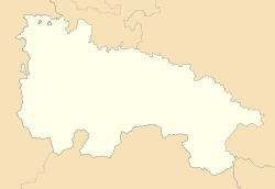
Zarzosa is a village in the province and autonomous community of La Rioja, Spain. The municipality covers an area of 18.29 square kilometres (7.06 sq mi) and as of 2011 had a population of 15 people.[2]
References
- ^ Municipal Register of Spain 2018. National Statistics Institute.
- ^ "La Rioja: Población por municipios y sexo:Cifras oficiales de población resultantes de la revisión del Padrón municipal a 1 de enero de 2011". Instituto Nacional de Estadística. Retrieved 28 May 2012.


