Dirol: Difference between revisions
Appearance
Content deleted Content added
m →References: add authority control |
m references |
||
| Line 7: | Line 7: | ||
|arrondissement = Clamecy |
|arrondissement = Clamecy |
||
|canton = Clamecy |
|canton = Clamecy |
||
|intercommunality = |
|intercommunality = |
||
|mayor = Michelle Ruz |
|mayor = Michelle Ruz |
||
|term = 2008–2014 |
|term = 2008–2014 |
||
| Line 28: | Line 28: | ||
==References== |
==References== |
||
* [http://www.insee.fr/fr/methodes/nomenclatures/cog/fichecommunale.asp?codedep=58&codecom=098 INSEE commune file] |
* [http://www.insee.fr/fr/methodes/nomenclatures/cog/fichecommunale.asp?codedep=58&codecom=098 INSEE commune file] |
||
{{reflist}} |
|||
{{commons category}} |
{{commons category}} |
||
{{Nièvre communes}} |
{{Nièvre communes}} |
||
{{authority control}} |
{{authority control}} |
||
Revision as of 13:28, 12 January 2021
Dirol | |
|---|---|
| Coordinates: 47°19′02″N 3°39′17″E / 47.3172°N 3.6547°E | |
| Country | France |
| Region | Bourgogne-Franche-Comté |
| Department | Nièvre |
| Arrondissement | Clamecy |
| Canton | Clamecy |
| Government | |
| • Mayor (2008–2014) | Michelle Ruz |
| Area 1 | 9.48 km2 (3.66 sq mi) |
| Population (2021)[1] | 108 |
| • Density | 11/km2 (30/sq mi) |
| Time zone | UTC+01:00 (CET) |
| • Summer (DST) | UTC+02:00 (CEST) |
| INSEE/Postal code | 58098 /58190 |
| Elevation | 167–223 m (548–732 ft) |
| 1 French Land Register data, which excludes lakes, ponds, glaciers > 1 km2 (0.386 sq mi or 247 acres) and river estuaries. | |
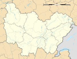
Dirol is a commune in the Nièvre department in central France.
Demographics
The January 2006 estimation was 142 people, down from the 1999 census population of 143.
See also
References
- ^ "Populations légales 2021" (in French). The National Institute of Statistics and Economic Studies. 28 December 2023.
Wikimedia Commons has media related to Dirol.


