Cowley, Derbyshire: Difference between revisions
Magioladitis (talk | contribs) m →References: Replace magic links with templates per RfC, replaced: ISBN 0-14-143994-7 → {{ISBN|0-14-143994-7}} using AWB (12151) |
Rescuing 1 sources and tagging 0 as dead. #IABot (v1.5beta) |
||
| Line 27: | Line 27: | ||
{{Reflist|refs= |
{{Reflist|refs= |
||
<ref name=CowMis>{{cite web |
<ref name=CowMis>{{cite web|url=http://www.dronfieldtogether.org.uk/churches/cowley-mission|title=Cowley Mission|author=|date=|work=|publisher=|accessdate=2011-02-05|deadurl=yes|archiveurl=https://web.archive.org/web/20120319215734/http://www.dronfieldtogether.org.uk/churches/cowley-mission|archivedate=2012-03-19|df=}}</ref> |
||
<ref name=CowleyWD>{{cite web|url=http://welldressing.com/venue.php?id=32|website=www.welldresing.com|title=Cowley Well Dressing|accessdate=21 January 2016}}</ref> |
<ref name=CowleyWD>{{cite web|url=http://welldressing.com/venue.php?id=32|website=www.welldresing.com|title=Cowley Well Dressing|accessdate=21 January 2016}}</ref> |
||
Revision as of 23:54, 13 August 2017
| Cowley | |
|---|---|
 The small village of Cowley, with the white-painted Mission in the distance. | |
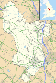
Location within Derbyshire | |
| OS grid reference | SK338770 |
| District | |
| Shire county | |
| Region | |
| Country | England |
| Sovereign state | United Kingdom |
| Post town | DRONFIELD |
| Postcode district | S18 |
| Police | Derbyshire |
| Fire | Derbyshire |
| Ambulance | East Midlands |
Cowley is a small dispersed settlement in North East Derbyshire, consisting of a few private houses and functioning farms strung out along Cowley Lane, which runs between the village of Holmesfield and the "Hill Top" neighbourhood of the town of Dronfield(where the population is included). It holds an annual well dressing[1] in the grounds of Cowley Mission, a small chapel founded in 1888 and still active.[2]
History
Cowley is mentioned in the Domesday book as belonging to Henry de Ferrers and being worth ten shillings. Henry was given a large number of manors in Derbyshire including Doveridge, Breaston, Duffield and Hartshorne.[3]
The name Cowley has been described as coming from two Old English words, col for coal or earlier charcoal and leah for clearing, suggesting the charcoal burners' clearing. Coal (the Silkstone seam) is close to the surface in this area and has been worked for centuries,[4] though no longer. Early coal workings would have been shallow, probably bell pits; the nearest, deeper shaft marked on the Ordnance Survey map is about 800 m north of Cowley at SK337778, on the edge of modern Dronfield.
References
- ^ "Cowley Well Dressing". www.welldresing.com. Retrieved 21 January 2016.
- ^ "Cowley Mission". Archived from the original on 2012-03-19. Retrieved 2011-02-05.
{{cite web}}: Unknown parameter|deadurl=ignored (|url-status=suggested) (help) - ^ Domesday Book: A Complete Translation. London: Penguin, 2003. ISBN 0-14-143994-7 p.748
- ^ Nixon, Frank (1969). Industrial Archaeology of Derbbysyire. Newton Abbot: David & Charles. ISBN 978-0-7153-4351-7.
External links
![]() Media related to Cowley, Derbyshire at Wikimedia Commons
Media related to Cowley, Derbyshire at Wikimedia Commons

