Peters Hill Limestone
Appearance
| Peters Hill Limestone | |
|---|---|
| Stratigraphic range: Santonian ~ | |
| Type | Formation |
| Underlies | Back River Formation |
| Overlies | unconformably on the Arthurs Seat Formation (andesite, basalt and conglomerate) |
| Thickness | up to 26 m (85 ft) |
| Lithology | |
| Primary | Limestone |
| Other | Conglomerate |
| Location | |
| Coordinates | 18°06′N 77°12′W / 18.1°N 77.2°W |
| Approximate paleocoordinates | 16°36′N 63°00′W / 16.6°N 63.0°W |
| Region | Clarendon Parish |
| Country | |
| Type section | |
| Named for | Peters' Hill |
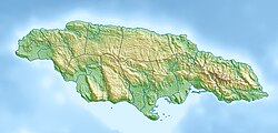
The Peters Hill Limestone or Peters Hill Formation is a geologic formation in Jamaica. It preserves fossils such as rudists, echinoids and corals from the Santonian stage of the Cretaceous Period.[1][2]
See also
[edit]References
[edit]- ^ Bartolini, Claudio and Richard T. Buffler (editor), The Circum-Gulf of Mexico and the Caribbean: Hydrocarbon Habitats, Basin Formation, and Plate Tectonics (AAPG Memoir), American Association of Petroleum Geologists, 2003, p. 611 ISBN 978-0891813606
- ^ Peters Hill Limestone at Fossilworks.org
Further reading
[edit]- L. J. Chubb. 1971. Rudists of Jamaica. Palaeontographica Americana 7(45):161-257

