Aflao
Aflao | |
|---|---|
 | |
| Coordinates: 06°08′48.4″N 01°10′47.6″E / 6.146778°N 1.179889°E | |
| Country | |
| Region | |
| District | Ketu South District |
| Population (2012) | |
| • Total | 66,546[1] |
| Ranked 28th in Ghana | |
| Time zone | GMT |
| • Summer (DST) | GMT |
| Area code | +233 (3625) |
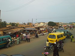
Aflao is a town in Ketu South District in the Volta Region on Ghana's border with Togo. Aflao is the twenty-eighth most populous settlement in Ghana, in terms of population, with a population of 96,550 people.[1]
In the 18th century, Aflao served as one of the major markets for the slave trade. Aflao is a big Land shared by the border of Ghana and Togo. So we have Aflao of Ghana and Aflao of Togo. The culture of this land base on their clothes called Kente or kete. Their local music is Agbadja and Brekete. Ghana authorities plan to creat a unique common post at Aflao.
History
Aflao people were war refugees of Phla extraction from Grand Popo in Benin.The exodus from Grand Popo was the result of the Wars by the Kingdom of Dahomey for access to the seaboard and European trading forts along the coast of Benin and Togo. Other war refugees who were of Ga Dangme extraction and displaced by the Akwamu wars also settled in Aflao.The Ga Dangme settled in the suburbs of Teshie, Gbugbla and Batorme. Constant skirmishes with the Bes of Togo for land and fishing rights compelled some of the Ga Dangme to relocate to Agortime area to join their kinsmen there.
Etymology
Ewe Fla:wo Phla/ Phera people
Phla/ Phera belongs to the Gbe(Tadoid) language cluster [2]
Geography

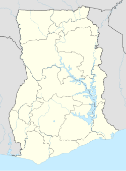
Aflao is located on the eastern coast of Ghana and is the major border town with neighboring Togo.
Chieftaincy
Aflao - Ghana as a traditional area has Togbui Amenya Fiti V as its Paramount Chief.[3] He is the traditional ruler of the land and performs traditional administrative and ceremonial functions in the area. Aflao - Togo has a different chiefs cause of the different villages on this Land. We have education school on the border of Lome that teach EWE the local language of Aflao.[4]
Industry
The Diamond Cement Ghana Limited factory is located at Aflao.[5][6]
In early 2014, a 2.5 km rail siding was completed to connect the cement works to the port of Lomé.[7] This siding crosses the border from Togo to Ghana and is of the 1,000 mm (3 ft 3+3⁄8 in) gauge.
Transportation
There are Public Transports from Aflao to major citie such as Accra ; Kumasi; Techiman; Mim, Ahafo ; Sunyani; Takoradi; Tema; Ho; Wa; Bolgatanga; Elubo.
Notable people
- Dzifa Gomashie, MP
- Joseph Kossivi Ahiator, artist
- Komla Dumor, journalist
- Thomas Amegnaglo, footballer
See also
References
- ^ a b "World Gazetteer online". World-gazetteer.com. Archived from the original on 2012-01-11.
- ^ "Le Ghana travaille un poste commun à Aflao". Republic of Togo. Archived from the original on 2013-07-03.
- ^ Togbui, Fiti. "Togbui Fiti Appeals For Gov't Intervention In Aflao Dispute". Spyghana. Retrieved 6 October 2014.
- ^ "Language Ideology and Practice on the Aflao-Lome Borderland: The Case of two Border School". Archived from the original on 2011-06-17.
- ^ "Production slumps at Diamond Cement". ghanaweb.com. 12 November 2013. Retrieved 26 February 2014.
- ^ "Railpage".
- ^ Cement siding opened.
- Dickson, K. B. "Trade Patterns in Ghana at the Beginning of the Eighteenth Century." Geographical Review 56.3 (1966): 417–431.


