Mount Datuk
Appearance
| Mount Datuk | |
|---|---|
 Western face of Datuk, with its distinctive tor visible as a bulge at the slopes of the north peak. | |
| Highest point | |
| Elevation | 884 m (2,900 ft) |
| Coordinates | 2°33′02.8″N 102°10′58.7″E / 2.550778°N 102.182972°E |
| Naming | |
| Native name | Gunung Datuk (Malay) |
| Geography | |
| Location | Rembau and Kuala Pilah Districts, Negeri Sembilan |
| Parent range | Titiwangsa Mountains |
| Climbing | |
| Easiest route | Hiking via Batang Nyamor (west) or Tampin (south) |
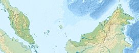
Mount Datuk (Malay: Gunung Datuk; Jawi: ڬونڠ داتق), also known as Mount Rembau, is a mountain situated on the border between Batang Nyamor, Rembau District and Johol, Kuala Pilah District in the Malaysian state of Negeri Sembilan, at the southern section of the Titiwangsa Mountains. At around 884 m (2900 ft), it is the highest mountain in the district of Rembau.[1]
Toponymy and history
The mountain gets its name from Datuk Perpatih Nan Sebatang, the creator of the Adat Perpatih, a matrilineal customary law that is widely practiced in the state.

