Abadan County
Abadan County
Persian: شهرستان آبادان | |
|---|---|
County | |
 Location of Abadan County in Khuzestan province | |
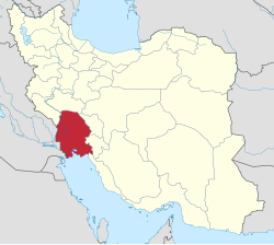
 Location of Khuzestan province in Iran | |
| Coordinates: 30°13′00″N 48°38′15″E / 30.21667°N 48.63750°E[1] | |
| Country | |
| Province | Khuzestan |
| Capital | Abadan |
| Districts | Central, Arvandkenar |
| Population (2016)[2] | |
| • Total | 298,090 |
| Time zone | UTC+3:30 (IRST) |
| Abadan County can be found at GEOnet Names Server, at this link, by opening the Advanced Search box, entering "9206378" in the "Unique Feature Id" form, and clicking on "Search Database". | |
Abadan County (Persian: شهرستان آبادان) is in Khuzestan province, Iran. Its capital is the city of Abadan on Abadan Island.
At the 2006 census, the county's population was 275,126 in 58,870 households.[3] The following census in 2011 counted 271,484 people in 69,946 households.[4] At the 2016 census, the county's population was 298,090 in 85,015 households.[2]
On May 11, 2020, Iran imposed a COVID-19 lockdown in Abadan County. All shops and offices in the county, except essential services, closed during this period. Authorities also closed access to Abadan from the Ahvaz and Bandar Mahshahr points of entry. These restrictions would expire on May 25.[5]
Administrative divisions
The population history and structural changes of Abadan County's administrative divisions over three consecutive censuses are shown in the following table. The latest census shows two districts, six rural districts, and three cities.[2]
| Administrative Divisions | 2006[3] | 2011[4] | 2016[2] |
|---|---|---|---|
| Central District | 250,116 | 247,273 | 270,622 |
| Bahmanshir-e Jonubi Rural District | 8,812 | 8,189 | 9,943 |
| Bahmanshir-e Shomali Rural District | 4,017 | 4,977 | 5,306 |
| Shalahi Rural District | 19,299 | 14,111 | 15,991 |
| Abadan (city) | 217,988 | 212,744 | 231,476 |
| Chavibdeh (city) | 7,252 | 7,906 | |
| Arvandkenar District | 25,010 | 24,211 | 27,461 |
| Minubar Rural District | 9,800 | 10,052 | 10,574 |
| Nasar Rural District | 5,275 | 5,102 | 5,585 |
| Nowabad Rural District | 174 | 148 | 129 |
| Arvandkenar (city) | 9,761 | 8,909 | 11,173 |
| Total | 275,126 | 271,484 | 298,090 |
References
- ^ OpenStreetMap contributors (20 July 2023). "Abadan County" (Map). OpenStreetMap. Retrieved 20 July 2023.
- ^ a b c d "Census of the Islamic Republic of Iran, 1395 (2016)". AMAR (in Persian). The Statistical Center of Iran. p. 06. Archived from the original (Excel) on 21 October 2020. Retrieved 19 December 2022.
- ^ a b "Census of the Islamic Republic of Iran, 1385 (2006)". AMAR (in Persian). The Statistical Center of Iran. p. 06. Archived from the original (Excel) on 20 September 2011. Retrieved 25 September 2022.
- ^ a b "Census of the Islamic Republic of Iran, 1390 (2011)" (Excel). Iran Data Portal (in Persian). The Statistical Center of Iran. p. 06. Retrieved 19 December 2022.
- ^ "COVID-19 Alert: Iran Imposes Lockdown on Abadan County Through May 15, Add'l Restrictions in 9 Cities". WorldAware. 11 May 2020. Archived from the original on 26 June 2020. Retrieved 26 June 2020.

