Nyerere National Park
| Nyerere National Park | |
|---|---|
| Selous Game Reserve | |
 | |
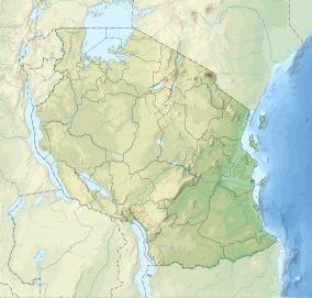
| Location | Location in Tanzania |
| Nearest city | Morogoro City |
| Coordinates | 9°0′S 37°24′E / 9.000°S 37.400°E |
| Area | 30,893 km2 |
| Established | 2019 |
| Governing body | Tanzania National Parks Authority |
| tanzaniaparks | |
Nyerere National Park (formerly the northern part of Selous Game Reserve, pronunciation: "Seluu") is the largest national park in Tanzania and also one of the world's largest wildlife sanctuaries and national parks. The total area of the park is 30,893 km2 (11,928 sq mi) and covers the big part of Liwale District in western Lindi Region, south west Pwani Region, north eastern Ruvuma Region and a big part of south eastern Morogoro Region.[1] The park is about the size of Belgium (Europe). Much of the area is in a wild state without being altered by human activities. The part of Selous game reserve is now running a hydro electric power. The park has a great river known as Rufiji River. Rufiji is Tanzania's largest river and is home to many crocodiles and hippopotamuses. It is also one of largest mangrove forests in the world located at its delta.
History
[edit]The original Selous Game Reserve traces its roots to 1896 when the then German Governor of Tanganyika proclaimed this vast area as a protected wildlife hunting reserve. Sometime in 1922 the reserve was named after Frederick Selous, a big game hunter turned wildlife conservationist. In 2019, it was decided by the Government of Tanzania that to further develop and enhance tourism in Selous, the northern part of the reserve will be excised to form the a new national park to be known as the Nyerere National Park, in honor of the first President of Tanzania, Mwalimu Julius Kambarage Nyerere.[2][3] This new park was formally gazetted as a National Park in 2019 and now falls under the administration of TANAPA (Tanzania National Parks Authority ).
Fauna and flora
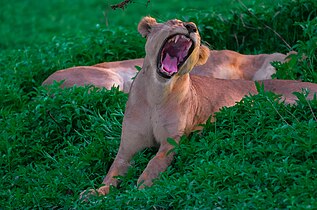
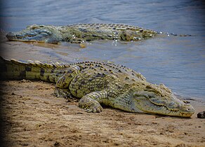
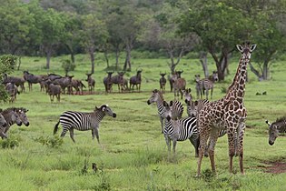
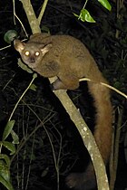
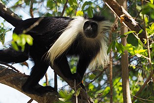
[edit]Nyerere National Park has a high level of biodiversity, with the most iconic African species all inhabiting the region in some capacity, including lions, leopards, Masai giraffe, herds of wildebeest and plains zebra, black rhinoceros, impala, Thomson's gazelle, spotted hyenas, countess birds, small mammals, reptiles, amphibians, fishes and invertebrates. A large number of hippopotamus and Nile crocodiles inhabit the waters of the Rufiji River. Most notably, the park is known for its prolific population of endangered African wild dogs.[4]
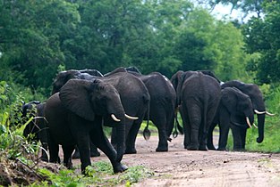
In the mid-1970s, Selous Game Reserve (and, by extension, Nyerere National Park) was home to a large number of elephants and rhinos, with estimates on the total number of elephants being over 100,000. Unfortunately, due to poor protection at the time, stealthy poachers have naturally found ways inside, and the animals' numbers dropped 66% just from 2009-2013, to around 13,000 elephants. It is now hoped that converting part of the reserve to an official National Park status will help control and minimize poaching.
Getting there
[edit]
Nyerere National Park can be accessed by road safari from either Dar es Salaam or Arusha. The road distance varies from 184 km to 230 km depending on which gate or entry point of Nyerere National Park you want to access. In terms of journey time, typically you want to allow for 6 hours for most Park entry gates such as Mtemere and Matembwe, and up to 6 to 6.5 hours for gates on the northern side of Selous Game Reserve. Road conditions are poor in places with the last 75 km to the park being on a bumpy gravel road.
The park can also be accessed by air. There are daily scheduled flights from either Dar es Salaam and Zanzibar with a flight time of under an hour to a variety of different airstrips in Nyerere. There are several airlines serving this route, some of which includes Regional Air, Coastal Aviation, Safari Air Link and Auric Air. All these airlines have a reliable service and credible safety record.
All visitors planning for a fly-in safari to Nyerere National Park need to know which airstrip in Nyerere Park they should use when booking their flights. There are quite a number of them in the park to avoid unnecessary long transfers (which also happens to be rather costly). Some of the most common airstrips include Mtemere, Matambwe, Sumbazi, Kiba, Beho Beho and Siwandu.
Gallery
[edit]See also
[edit]Further reading
[edit]- Baldus, Rolf D.; Siege, Ludwig; Jafferji, Javed (2005). Selous Game Reserve. Gallery Publications. ISBN 9789987667468.
References
[edit]- ^ "The Newly-Established Nyerere National Park". EABWNews. 5 February 2020. Retrieved 7 January 2021.
- ^ Yinglun, Shi, ed. (29 July 2019). "Tanzania starts process to establish Nyerere National Park in Selous". Xinhuanet. Archived from the original on July 29, 2019. Retrieved 7 January 2021.
- ^ Lyimo, Henry (25 November 2019). "New Nyerere National park established". Daily News (Tanzania). Retrieved 7 January 2021.
- ^ "Animals in Nyerere National Park, Tanzania: Wildlife that can be seen in Selous & Nyerere National Park, including Big Five". www.nyererenationalpark.net. Retrieved 2021-03-12.

