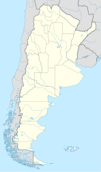
Pluma de Pato
Appearance
You can help expand this article with text translated from the corresponding article in Spanish. (May 2010) Click [show] for important translation instructions.
|
Pluma de Pato | |
|---|---|
Municipality and village | |
| Coordinates: 23°23′S 63°06′W / 23.383°S 63.100°W | |
| Country | |
| Province | Salta Province |
| Elevation | 211 m (692 ft) |
| Population (2001) | |
| • Total | 220 |
| Postal code | A4554 |
Pluma de Pato (Spanish for "Feather"' Latin: plūma "feather" and Andalusian Arabic: páṭṭ for "duck")[1] is a village and rural municipality in Salta Province in northwestern Argentina.[2]
References
[edit]- ^ Harper, Douglas. "pluma". Etymonline.com. Retrieved 24 April 2015.
- ^ Ministerio del Interior (in Spanish)
23°23′S 63°06′W / 23.383°S 63.100°W

