
Coquitlam
Template:Infobox Municipality of British Columbia Template:Two other uses Coquitlam (IPA: [koˈkwɪt.ləm]) is a mid-sized city in the Lower Mainland of British Columbia, Canada. It has population of 113,498 (2005), and is one of the 21 municipalities comprising the Greater Vancouver Regional District. Coquitlam is mainly a suburban city, with a large and affluent multicultural community in a region known as Westwood Plateau. The mayor of Coquitlam is Maxine Wilson.
Geography and Location
Coquitlam is situated some 10 to 15 km (7 to 10 miles) east of Vancouver, British Columbia within the Greater Vancouver Regional District (located at 49°17′0″N 122°47′30″W / 49.28333°N 122.79167°W), where the Coquitlam River connects with the Fraser River and extends northeast along the Pitt River towards the Coquitlam and Pitt lakes. Like Vancouver, Coquitlam is in the Pacific Time Zone (winter UTC−8, summer UTC−7), and the Pacific Maritime Ecozone.
Coquitlam borders Burnaby and Port Moody to the west, New Westminster to the southwest, Port Coquitlam to the southeast, and the Coast Mountains to the north.
History
The Coast Salish were the first people to live in this area. The word Kwikwetlem means "smell like fish" in the Halkomelem language [1]. Simon Fraser came through the region in 1808, and in the 1860s Europeans gradually started settling the area.
Coquitlam began as a "place-in-between" since the area was opened up with the construction of North Road in the mid-1800s. While the purpose of the road was to provide Royal Engineers in New Westminster access to the year-round port facilities in Port Moody, the effect was to provide access to the vast area between and to the east. This led to a period of settlement and agriculture, providing slow and steady growth leading up to incorporation of the municipality of the District of Coquitlam in 1891.
The young municipality got its first boost in the dying years of the 19th century when Frank Ross and James McLaren opened Fraser Mills, a $350,000, then state-of-the-art lumber mill on the north bank of the Fraser River. By 1908, a mill town of 20 houses, a store, post office, hospital, office block, barber shop, and pool hall had grown around the mill.
A year later one of the most significant events in Coquitlam's history took place. Mill owners, in search of workers, turned their attention to the experienced logging culture of Québec, and in 1909 a contingent of 110 French Canadians arrived, recruited for work at Fraser Mills. With the arrival of a second contingent in June 1910, Maillardville was born. Named for Father Maillard, a young Oblate from France, Maillardville was more than just a French-Canadian enclave in Western Canada: it was a vibrant community, the largest Francophone centre west of Manitoba, and the seed for the future growth of Coquitlam.
While the passing of time has diluted the use of the French language in British Columbia, it is still heard on the streets and in the homes on the south slope of Coquitlam. Maillardville's past is recognized in street names that honour early pioneers and in local redevelopments which reflect its French-Canadian heritage.
The steady growth continued throughout the first half of the 20th century, helped in part by the region's strategic position on Canada's west coast. The opening of Lougheed Highway in 1953 made the city more accessible and set the stage for residential growth in the early 1960s. Coquitlam experienced a period of boom in the mid-1970s that continues today.
Politics
Federal
There are two federal ridings which cut through Coquitlam. James Moore, of the Conservative Party of Canada (CPC), represents the riding of Port Moody—Westwood—Port Coquitlam. Dawn Black, of the New Democratic Party (NDP), represents the New Westminster—Coquitlam riding.
Provincial
Coquitlam is represented by three provincial MLA's the Legislative Assembly of British Columbia. In 2005, Iain Black was elected the MLA in the riding of Port Moody-Westwood, which includes northern Coquitlam and Coquitlam Town Centre. Black is a member of the BC Liberal Party. Diane Thorne is the provincial representative of Coquitlam-Maillardville, also elected in 2005. She is a member of the NDP. Harry Bloy is the MLA for Burquitlam, which includes western Coquitlam. He is a member of the BC Liberals.
City
The following city council members were elected in 2005:
- Maxine Wilson, mayor
- Brent Asmundson
- Fin Donnelly
- Louella Hollington
- Barrie Lynch
- Doug Macdonnell
- Mae Reid
- Lou Sekora
- Richard Stewart
Demographics
According to the 2001 Canadian census,[2] there were 112,890 people living in the municipality in 41,481 private dwellings. Of the 40,220 households: 37% contained a married couple with children, 25% contained a married couple without children, and 21% were one-person households. Of the 31,390 reported families: 77% were married couples with an average of 3.2 persons per family, 15% were lone-parents with an average of 2.5 persons per family, and 8% were common-law couples with an average of 2.5 persons per family. The median age of Coquitlam’s population was 37.0 years, slightly younger than the British Columbia median of 38.4 years. Coquitlam had 81.0% of its residents over the age of 14, nearly the same as the provincial average of 81.9%.
Also, according to the 2001 Canadian census, the two most dominant religions are Protestantism with 26% and Catholic with 23% claiming affiliation. Coquitlam, with 0.9%, had fewer Sikhs than the provincial average of 3.5%, but more Muslims, at 6.1%, compared to the provincial average of 1.5%. About 37% of Coquitlam residents were foreign-born and of those 53% had immigrated between 1991 and 2001, much higher than the 26% foreign-born and 36% foreign-born and immigrated between 1991 and 2001 provincial averages. Of the 34% who claimed to be a visible minority, higher than the 21% provincial average, 52% were Chinese, 11% were Korean, 9% were South Asian, and 7% were Filipino.
Education

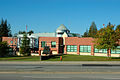
Coquitlam is served by School District 43 Coquitlam. High schools in Coquitlam include Dr. Charles Best Secondary School, Centennial School, Pinetree Secondary School, and Gleneagle Secondary School schools. There are also several middle schools in Coquitlam, which include Maillard Middle School and Montgomery Middle School.
There are two major universities, University of British Columbia and Simon Fraser University, located in the nearby municipalities. Capilano College, Langara College, Vancouver Community College (VCC), Kwantlen University College, and Douglas College have campuses throughout the Greater Vancouver, with Douglas College maintaining a campus near the Coquitlam's city centre; these serve the local post-secondary education needs with career, trade, and university-transfer programs. British Columbia Institute of Technology (BCIT) in the neighbouring Burnaby provides polytechnic education and grants degrees in several fields, and nearby Vancouver is also home to Emily Carr Institute of Art and Design and Vancouver Film School.
The Coquitlam Public Library has two branches: City Centre and Poirier.
Employment
The largest employers in Coquitlam are the City of Coquitlam with approximately 850 employees, Art in Motion with approximately 750 employees, and Real Canadian Superstore with approximately 500 employees[3].
The current unemployment rate is 7%.
Land use
Coquitlam, with a land area of about 150 square kilometres, is the largest municipality in the Tri-Cities region. Compared to other cities and municipalities in the Greater Vancouver Regional District, this area had a late start in economic development. It was not until the 1950s that the potential of the region's land began to be tapped[citation needed].
Development in Coquitlam has had an unusual amount of influence from the provincial government in recent years. In 1984, the provincial government sold 57 hectares (140 acres) formerly attached to Riverview Hospital to Molnar Developments. Shortly afterwards, this land was subdivided and became Riverview Heights, with about 250 single family homes. The remaining 240 acres of this still-active mental hospital are the subject of much speculation among developers, environmentalists, and conservationists alike.
Development in northern Coquitlam was rapidly increased during the early 1990s, after the sale of 650 hectares (1600 acres) of crown land to Wesbild consisting of 4000 single family lots, 700 townhouse sites, and 400 apartment unit sites. This steep mountainside on the south slope of Eagle Mountain (known locally as Eagle Ridge), covered in second-growth forest, is the area now known as Westwood Plateau. The development of this area, as originally planned in 1987, is nearly complete. Urban development will soon be shifting to the northeastern portion of the city, now that the long-planned-for link across the Coquitlam River at David Avenue finally connects the two halves of Coquitlam.
Coquitlam Land Use (2001) in Hectares (Ha)
Total 15,250
- Agricultural Land 381.25
- Extractive Industry 138.00
- Harvesting and Research 0.00
- Residential
- Single Family 2790.75
- Rural 488.00
- Town/Low-rise 244.00
- High-rise 15.25
- Commercial 288.75
- Industrial 427.00
- Institutional 350.75
- Transport. Comm., Utilities 274.50
- Recreation / Nature Areas 5429.00
- Open / Undeveloped 3080.50
- GVRD Watershed 1342.00
Parks, Recreation and Community
Coquitlam has a considerable number of open green spaces, with the total area of over 890 hectares (2200 acres.) There are over 80 municipal parks and natural areas, with Mundy Park being among the biggest, located roughly in the centre of the city; Ridge Park is another major park located in the highlands near the city's northern edge. Pinecone Burke Provincial Park, Minnekhada Regional Park, and Pitt Addington Marsh are on the northern and eastern border of the city, while Indian Arm Provincial Park and the restricted area of the GVRD's Coquitlam watershed border Coquitlam to the north.
Coquitlam does not have any beaches within the city limits, but the Tri-Cities offers freshwater beaches located in Anmore (Buntzen Lake, White Pine Beach at Sasamat Lake) and saltwater beaches in Belcarra and Port Moody.
The city is responsible for the maintenance of numerous sports and recreation fields, including 40 sand-based and soil sportsfields, two FieldTurf fields, 35 ball diamonds, several all-weather surfaces, a bowling green, a croquet/bocce court, and a cricket pitch. The city also operates Percy Perry Stadium, a multi-purpose facility featuring a 400mm track, areas for activities such as long/triple jump, high jump, shotput/discus/hammer throw, and a FieldTurf surface for football and soccer.
Sports Arena - The city manages the Coquitlam Sports Centre, which features a 185 ft × 80 ft (56 m × 24 m) ice surface with seating for 1,500 people. An annex provides an additional NHL-standard 200 ft × 85 ft (61 m × 26 m) ice surface while the curling rink provides curlers with six sheets of ice. Privately owned Planet Ice features 4 additional skating rinks, and more rinks are found throughout the Tri-Cities.
Swimming - The city manages numerous pools and water parks, including:
- City Centre Aquatic Complex
- Chimo Indoor Pool (currently being replaced by the new Poirier Aquatic Facility)
- 3 outdoor pools (Eagle Ridge, Rochester, Spani)
- 2 outdoor wading pools (Blue Mountain, Mackin)
- 3 spray parks (Blue Mountain, Panorama, Town Centre)
Community Centres - The city manages five community centres, including:
- Pinetree Community Centre
- Dogwood Pavilion
- Poirier Community Centre
- Centennial Activity Centre
- Summit Community Centre
Golf - In addition to courses in neighboring communities in the Tri-Cities, Coquitlam itself is home to several golf facilities, including:
- Westwood Plateau Golf & Country Club (public, 18 holes)
- Westwood Plateau Golf Academy (public, 9 holes)
- Vancouver Golf Club (private, 18 holes)
- Eaglequest Golf Centre (public, 9 holes par 3)
Transportation
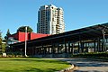
Coquitlam is served by the Greater Vancouver Transportation Authority (TransLink), which is responsible for both public transit and major roads. There is regular bus service on numerous lines running throughout the city and connecting it to other municipalities in the Greater Vancouver Regional District. The 97 B-line express bus service connects the central part of the city to the Lougheed Town Centre SkyTrain station in neighbouring Burnaby. Plans to replace this express bus line with the Evergreen Line light rail service by the end of 2011 are already in progress. Most buses are wheelchair accessible and a large number carry bike racks, able to carry two wheelchairs and bicycles respectively. West Coast Express provides a morning rush-hour rail service to downtown Vancouver and evening rush-hour rail service as far as Mission.
For motorists, the Highway 1 provides quick access to Burnaby, Vancouver, Surrey, and many other municipalities in the Lower Mainland. Lougheed Highway provides a link to Vancouver and Burnaby to the west, and Pitt Meadows, Maple Ridge and other municipalities to the east.
Coquitlam is served by two international airports. Vancouver International Airport, located on Sea Island in the city of Richmond to the west, provides most of the air access to the region. The airport (YVR) is the second busiest in Canada and one of the busiest international airports on the West Coast of North America. Abbotsford International Airport, located to the east, is the sixth busiest airport in Canada. Nearby Pitt Meadows Airport provides services for smaller aircraft.
Greyhound Lines of Canada has a bus depot in south Coquitlam for both passenger and package service.
Residents and visitors wishing to travel to Vancouver Island, the Gulf Islands, and other destinations along the Inside Passage may use the BC Ferries car and passenger ferry service from two terminals in the communities of Tsawwassen and Horseshoe Bay, south and north of Vancouver respectively.
Police
Coquitlam contracts out its police service to the Royal Canadian Mounted Police, which is operated out of the RCMP's E Division.
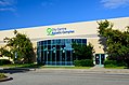
Health Care
Coquitlam is served by the Fraser Health Authority (FHA). The Tri-Cities are served by the 180-bed Eagle Ridge Hospital on the Port Moody/Coquitlam city boundary. As well, the FHA operates the 352-bed Royal Columbian Hospital just south of Coquitlam in New Westminster. Both hospitals offer 24/7 emergency rooms. Coquitlam is also the home of Riverview Hospital, a large mental health facility that is also frequently used as a filming location for numerous movies (Along Came A Spider, Jennifer Eight, Romeo Must Die, The Butterfly Effect) and television shows (The X-Files, Smallville, Dark Angel). City residents are also served by many privately-owned health care clinics.
Media
In addition to Vancouver-based media outlets, Coquitlam is served by two bi-weekly community newspapers:
Town Centre
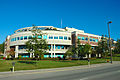
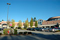
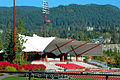
Geographically, Coquitlam has two large parcels of land (one in the south-west, the other in the north-east), with a smaller central area between them. This central area, Coquitlam Town Centre, was designated as a "Regional Town Centre" under the GVRD’s Livable Region Strategic Plan. The concept of a Regional Town Centre for the area dates back to 1975, and is intended to have a high concentration of high-density housing, offices, cultural, entertainment and education facilities to serve major growth areas of the region, served by rapid transit service.
Coquitlam Town Centre is currently undergoing an update of the Town Centre plan. Besides private office buildings and residential skyscrapers, public facilities presently at the Town Centre include:
-
 City hall
 -
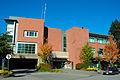 Public library
 -
 Police station
 -
 Fire hall
 -
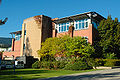
 Innovation Centre
 -
 Douglas College
 -
 Pinetree Secondary School
 -
 Evergreen Cultural Centre
 -
 Aquatic Centre
 -
 Percy Perry Stadium
 -
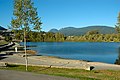 Lafarge Lake


Trivia
- The name Coquitlam is said to be derived from a Coast Salish term meaning "the little red fish". However, Chuck Strahl, author of the "Greater Vancouver Book", says that the name Coquitlam stems from the Halkomelem word meaning 'stinking of fish slime' and attributes the following quote to B.C.-place-name experts Helen B. and G.P.V. Akrigg. "During a great winter famine, the Coquitlam people sold themselves into slavery to the more numerous and prosperous Kwantlen nation. The new slaves, while butchering large quantities of salmon for their masters, got covered with fish slime - hence the name."
- Famous Canadian musician and activist Matthew Good is from Coquitlam. He graduated from Centennial School in 1989. The school was featured in the "Alert Status Red" video, and its cheerleading squad recorded for "Giant".
- Female model and host of MTV Select and G4TechTV Amanda Mackay also attended Centennial where she started her journalism career writing for the school's student newspaper.
- Canadian women's national soccer player Brittany Timko attended Centennial School.
- Rescuers for Hurricane Katrina from the Canadian Air Force came from Coquitlam and Halifax. Most of them came from Coquitlam.
- Former English Premiership goalkeeper Craig Forrest is from Coquitlam, as is young Hibernian FC starlet Keegan Ayre
Surrounding municipalities
Places adjacent to Coquitlam | |
|---|---|
See Also
References
- ^ Greater Vancouver Regional District, A Profile of Aboriginal People, First Nations and Indian Reserves in Greater Vancouver, June 2003.
- ^ Statistics Canada, Community Highlights for Coquitlam, 2001 Community Profiles, February 16 2006.
- ^ Coquitlam Employers
External links
Municipalities of Metro Vancouver | |
|---|---|
| Population over 500,000 | |
| Population over 100,000 | |
| Population over 50,000 | |
| Population over 10,000 | |
| Population under 10,000 | |
| Unincorporated areas | |
Subdivisions of British Columbia | |
|---|---|
| Subdivisions | |
| Communities | |
| Metro areas and agglomerations | |