Freienfeld
Freienfeld (Campo di Trens) | |
|---|---|
| Comune di Freienfeld (Campo di Trens) | |
| Coordinates: 46°53′N 11°29′E / 46.883°N 11.483°E | |
| Country | Italy |
| Region | Trentino-Alto Adige/Südtirol |
| Province | Bolzano-Bozen (BZ) |
| Frazioni | Valgenauna, Flanes, Castelpietra, Rizzolo, Fuldres, Novale Basso, Dosso, Pruno, Mules, Stilves, Trens |
| Government | |
| • Mayor | Armin Holzer |
| Area | |
• Total | 95.39 km2 (36.83 sq mi) |
| Population (Dec. 2004)[2] | |
• Total | 2,645 |
| Demonym(s) | Italian: campotrensini German: |
| Time zone | UTC+1 (CET) |
| • Summer (DST) | UTC+2 (CEST) |
| Postal code | 39040 |
| Dialing code | 0472 |
| Website | www.gvcc.net/soci/campo_di_trens.htm |
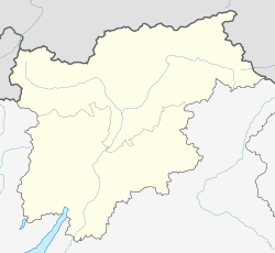
Freienfeld (Campo di Trens) (Italian: Campo di Trens; German: Freienfeld; Archaic (827 AD): Torrentes, Trentas, Trents, or Trentes; Latin: Torrens) is a comune (municipality) in the province of Bolzano-Bozen in the Italian region Trentino-Alto Adige/Südtirol, located about 100 km northeast of the city of Trento and about 45 km north of the city of Bolzano (Bozen). As of 31 December 2004, it had a population of 2,565 and an area of 95.3 km².[3]
The municipality of Freienfeld contains the frazioni (subdivisions, mainly villages and hamlets) Valgenauna, Flanes, Castelpietra, Rizzolo, Fuldres, Novale Basso, Dosso, Pruno, Mules, Stilves, and Trens.
Freienfeld borders the following municipalities: Franzensfeste (Fortezza), Ratschings (Racines), Mühlbach (Rio di Pusteria), Sarntal (Sarentino), Pfitsch (Val di Vizze), and Sterzing (Vipiteno).
Demographic evolution

References
- ^ "Superficie di Comuni Province e Regioni italiane al 9 ottobre 2011". Italian National Institute of Statistics. Retrieved 16 March 2019.
- ^ "Popolazione Residente al 1° Gennaio 2018". Italian National Institute of Statistics. Retrieved 16 March 2019.
- ^ All demographics and other statistics: Italian statistical institute Istat.
External links


