Tótkomlós
Appearance
You can help expand this article with text translated from the corresponding article in Hungarian. Click [show] for important translation instructions.
|
Tótkomlós | |
|---|---|
 | |
| Country | |
| County | Békés |
| Area | |
• Total | 125.4 km2 (48.4 sq mi) |
| Population (2001) | |
• Total | 6,615 |
| • Density | 52.75/km2 (136.6/sq mi) |
| Time zone | UTC+1 (CET) |
| • Summer (DST) | UTC+2 (CEST) |
| Postal code | 5940 |
| Area code | 68 |

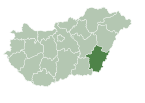
Tótkomlós (Template:Lang-sk, both means "Slovak Komlós") is a town in Békés county, in the Southern Great Plain region of south-east Hungary.
Geography
It covers an area of 125.4km² and has a population of 6615 people (2001).
People
- János Jankó (Sr.) (1833 - 1896) (hu)
- Zsuzsa Gyurkovics (1929)
- Ernő Malya (born 1936)
- Pál Závada (born 1954) (hu)


