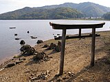
Lake Hibara
Appearance
| Lake Hibara | |
|---|---|
| Location | Kitashiobara |
| Coordinates | 37°41′0″N 140°3′20″E / 37.68333°N 140.05556°E |
| Basin countries | Japan |
| Surface area | 10.7 km² |
| Max. depth | 30.5 m |
| Water volume | 0.13 km³ |
| Shore length1 | 31.5 km |
| Surface elevation | 822.0 m |
| 1 Shore length is not a well-defined measure. | |
Wikimedia Commons has media related to Category:Lake Hibara.
Lake Hibara (桧原湖, Hibara-ko) is a lake located in Yama District, Fukushima, Japan. It is a part of the Bandai-Asahi National Park and is the largest of the lakes in the Bandai-kōgen plateau.[1]
Formation
A mesotrophic lake, Lake Hibara was formed as a result of the July 15, 1888 eruption of Mount Bandai. The resulting debris avalanche created a natural dam that then filled with water, submerging Hibara Village (桧原村, Hibara-mura). The remains of Hibara Village still lie at the bottom of the lake.[2]
Recreation
A tourist industry has built up around Lake Hibara, offering hiking trails, pleasure cruises, and campgrounds and other lodging. In the winter, ice fishing is popular.
Gallery
Views of Lake Hibara
-
Lake Hobara in winter with a snow-covered bank
-
Lake Hibara-ko2.JPG
-
Looking south
-
Submerged torii from the former location of Hobara Village
Notes
References
- Takeda, Toru; Hishinuma, Tomio; Kamieda, Kinuyo; Dale, Leigh; Oguma, Chiyoichi (August 10, 1988). "Hello! Fukushima - International Exchange Guide Book" (Document). Fukushima City: Fukushima Mimpo PressTemplate:Inconsistent citations
{{cite document}}: Unknown parameter|edition=ignored (help)CS1 maint: postscript (link)


