Sayram District
Appearance
Sayram | |
|---|---|
District | |
| Сайрам ауданы | |
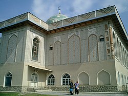
 Sayram mosque | |
 | |
| Country | |
| Province | South Kazakhstan Province |
| Administrative center | Aksukent[disambiguation needed] |
| Population (2013) | |
| • Total | 311,155 |
| Time zone | UTC+6 (East) |
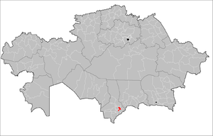
Sayram (Kazakh: Сайрам ауданы) is a district of South Kazakhstan Province in southern Kazakhstan. The administrative center of the district is the selo of Aksukent.[1] The historic city of Sayram is located in this district, and gives it its name. Population: 281,898 (2009 Census results);[2] 212,929 (1999 Census results).[2]
References
- ^ www.geonames.de Subdivisions of Kazakhstan in local languages
- ^ a b "Население Республики Казахстан" [Population of the Republic of Kazakhstan] (in Russian). Департамент социальной и демографической статистики. Retrieved 8 December 2013.

