Eshbol
Appearance
Eshbol | |
|---|---|
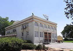
 Village synagogue | |
| Coordinates: 31°26′47.4″N 34°40′1.55″E / 31.446500°N 34.6670972°E | |
| Country | Israel |
| District | Southern |
| Council | Merhavim |
| Affiliation | Moshavim Movement |
| Founded | 1954 |
| Founded by | Persian Jews |
| Population (2022)[1] | 662 |
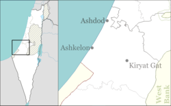
Eshbol (Template:Lang-he-n, lit. Spadix) is a moshav in southern Israel. Located in the north-western Negev near Netivot and Rahat, it falls under the jurisdiction of Merhavim Regional Council. In 2022 it had a population of 662.
History
The village was established in 1954 as a farm by members of the "Eshbol" organisation who were immigrants from Iran.
References
- ^ "Regional Statistics". Israel Central Bureau of Statistics. Retrieved 21 March 2024.
External links
- Eshbol Negev Information Center

