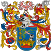
Porrogszentpál
Appearance
Porrogszentpál
| |
|---|---|
Village | |
| Coordinates: 46°17′10″N 17°00′54″E / 46.28616°N 17.01493°E | |
| Area | |
| • Total | 3.54 km2 (1.37 sq mi) |
| Population (2017) | |
| • Total | 86[1] |
| Demonym(s) | szentpáli, porrogszentpáli |
| Time zone | UTC+1 (CET) |
| • Summer (DST) | UTC+2 (CEST) |
| Postal code | 8858 |
| Area code | 82 |
Porrogszentpál (Slovene: Porog - Sveti Pavel) is a village in Somogy county, Hungary, where Somogy Slovenes lives.


