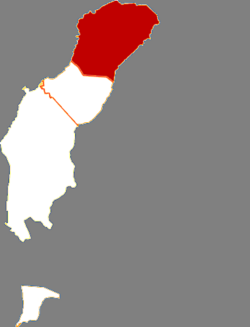
Orku, Karamay
Appearance
Orku
乌尔禾区 • ئورقۇ رايونى | |
|---|---|
 Orku in Karamay | |
 Karamay in Xinjiang | |
| Country | People's Republic of China |
| Autonomous region | Xinjiang |
| Prefecture-level city | Karamay |
| Time zone | UTC+8 (China Standard) |
Orku District (simplified Chinese: 乌尔禾区; traditional Chinese: 烏爾禾區; pinyin: Wū'ěrhé Qū; Template:Ug) is a district within the Xinjiang Uyghur Autonomous Region and is under the administrative jurisdiction of the Karamay City. It contains an area of 2,229 km2 (861 sq mi). According to the 2002 census, it has a population of 10,000.
Orku District is supplied with water by the Baiyang River and the Irtysh–Karamay Canal. The canal's Fengcheng Reservoir is located at the northern border of the district, about 15 km (9.3 mi) north of the district's main urban area.
