Ísafjarðarbær
Appearance
Ísafjarðarbær | |
|---|---|
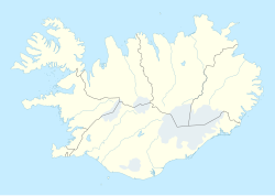
Settlements of Ísafjarðarbær | |
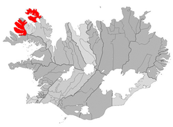
 Location of Ísafjarðarbær | |
| Coordinates: 66°04′N 23°9′W / 66.067°N 23.150°W | |
| Country | Iceland |
| Region | Westfjords |
| Constituency | Northwest Constituency |
| Government | |
| • Mayor | Arna Lára Jónsdóttir |
| Area | |
• Total | 2,379 km2 (919 sq mi) |
| Population (1 August 2024) | |
• Total | 4,002[1] |
| • Density | 1.53/km2 (4.0/sq mi) |
| Postal code(s) | 400, 401, 410, 425, 430, 470, 471 |
| Municipal number | 4200 |
| Website | isafjordur |
Ísafjarðarbær (Icelandic pronunciation: [ˈiːsaˌfjarðarˌpaiːr̥]) is a municipality of Iceland in the Westfjords region, created in 1996 from Flateyrarhreppur, Ísafjarðarkaupstaður, Mosvallahreppur, Mýrahreppur, Suðureyrarhreppur and Þingeyrarhreppur.[2]
Geography
The principal settlement is Ísafjörður, others being Hnífsdalur, Flateyri, Suðureyri and Þingeyri.
Education
- University Centre of the Westfjords — a higher education institute in Ísafjörður
- Flateyri Folk High School — a folk high school in Flateyri
- Menntaskólinn á Ísafirði — a gymnasium in Ísafjörður
Sports
Local football club Vestri plays in the country's second tier as of 2022. They play their home games at the Torfnesvöllur in Ísafjörður.
Transport
The municipality is served by Ísafjörður Airport.
Twin towns – sister cities
Ísafjarðarbær is twinned with:[3]
References
- ^ "Ísafjarðarbær: íbúarfjöldinn kominn yfir 4.000". Bæjarins besta (in Icelandic). 8 August 2024. Retrieved 9 August 2024.
- ^ "Hillir undir mikinn vöxt fyrir vestan". Morgunblaðið (in Icelandic). 14 July 2016. p. 4. Retrieved 9 August 2024.
- ^ "Vinabæir". isafjordur.is (in Icelandic). Ísafjarðarbær. Retrieved 2020-02-12.
External links
- Official website (in Icelandic)


