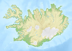
Ófærufoss
Appearance
| Ófærufoss | |
|---|---|
 | |
 | |
| Location | South of Iceland |
| Coordinates | 63°57′55.8″N 18°37′07.5″W / 63.965500°N 18.618750°W |
| Total height | 40 metres (130 ft) |
| Number of drops | 2 |
| Watercourse | Norðari-Ófærá |
Ófærufoss (Icelandic pronunciation: [ˈouːˌfaiːrʏˌfɔsː] ) is a waterfall situated in the Eldgjá chasm in the western part of Vatnajökull National Park, Iceland. Until the early 1990s a natural bridge spanned the falls, but it collapsed from natural causes.[1]
References

- ^ "Eldgja Fissure System, Katla Volcano, Iceland". Archived from the original on March 8, 2008. Retrieved 2007-08-06.

