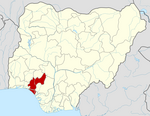
Akoko South-East
This article needs additional citations for verification. (May 2021) |
Akoko South-East
Uhami Isua | |
|---|---|
 | |
| Coordinates: 7°25′N 5°55′E / 7.42°N 5.91°E. | |
| Country | |
| State | Ondo State |
| Area | |
| • Land | 200 sq mi (530 km2) |
| Elevation | 1,142 ft (348 m) |
| Time zone | UTC+1 (WAT) |
 | |
Akoko South-East[1] is a Local Government Area in Ondo State, Nigeria.[2] Its headquarters are in Isua (Akoko).[3] Akoko South-East is one of six Local Government Areas in the Northern Senatorial District of Ondo State.[4][5]
Geography
The landscape is a mix of savannah and lowland forest. Annual rainfall ranges between 8–150 cm (3.1–59.1 in) per year with an average temperature of 28–35 °C (82–95 °F).[6] The territory is divided into Isua Oke and Isua Ile.[7]
History
The origins of Isua can be traced back to the ancient Benin Empire.[8]
Demographics
The population was 82,426 according to the 2006 census.[9]
Governance
In Isua, only those who come from the royal Odovia family can be crowned as king.
The king resides in Isua Oke.
| Location | Area/district |
|---|---|
| Abulenla | Supare-Akoko |
| Ago Ajayi | Oba-Akoko |
| Ago Flower | Supare-Akoko |
| Ago Ojo | Oba-Akoko |
| Ago Oka | Oba-Akoko |
| Ago-Orikuta | Supare-Akoko |
| Akunagba -Akoko | Akungba-Akoko |
| Akunnu | Akunnu/Isowopo |
| Alegunle | Oka-Akoko |
| Auga | Akunnu/Isowopo |
| Ayegunle | Ifira-Akoko |
| Epinmi-Akoko | Epinmi-Akoko |
| Etioro | Akungba-Akoko |
| Iboropa | Akunnu/Isowopo |
| Igboegun | Supare-Akoko |
| Igbonla | Supare-Akoko |
| Ikakumo | Akunnu/Isowopo |
| Ikun-Akoko | Ifira-Akoko |
| Ipe-Akoko | Ipe Akoko |
| Ise | Akunnu/Isowopo |
| Isua-Akoko | Isua akoko |
| Iwaro | Oka-Akoko |
| Oka-Akoko | Oka-Akoko |
| Ose-Oba | Oba-Akoko |
| Sosan-Akoko | Sosan -Akoko |
Ipe Akoko is a town in Akoko South East in Ondo State.[10]
Economy
It is an agricultural community. The town is situated on rocky terrain. It comprises ten quarters: Iba, Okun, Isinodo, Ilegbe, Igbede, Ugbe, Itoto, Ipaso, Uwi and Uthakpe quarters. The current king is His Royal Majesty, Oba Evangelist Francis Omokanjuola Apata, The Arogunbola II.
References
- ^ "Akoko South East (Local Government Area, Nigeria) - Population Statistics, Charts, Map and Location". www.citypopulation.de. Retrieved 2021-07-24.
- ^ "APC leaders accuse Akeredolu of threatening Buhari's victory in Ondo". 2019-02-19. Retrieved 2022-04-08.
- ^ "Figure 1: Map of Akoko South East Local Government Area, Ondo State..." ResearchGate. Retrieved 2021-06-02.
- ^ "Edo resonates as Ondo decides today". Vanguard News. 2020-10-10. Retrieved 2022-02-14.
- ^ "Ondo gov race: Battle of the zones". Punch Newspapers. 2016-07-16. Retrieved 2022-02-14.
- ^ "Ekpemi Weather Forecast for today and this week - My Weather Watcher - Akoko South East - Ondo - Nigeria 2021". justweather.org. Retrieved 2021-07-20.
- ^ "oluwasola daniels - Academia.edu". independent.academia.edu. Retrieved 2024-04-21.
- ^ "Country profile for Nigeria: INSI". newssafety.org. Retrieved 2022-04-08.
- ^ "List of Local Governments in Ondo State". nigerianfinder.com. Retrieved 2022-02-14.
- ^ "With akara, Ondo community holds fertility festival". Tribune Online. 2018-12-01. Retrieved 2022-02-14.
Further reading
- Chinwe I. Sanni1, Joshua Kayode2*, and Benson O. Ademiluyi (2019). Ethnobotany and Conservation of Indigenous Fruit Tree Species in Akoko Division of Ondo State, Nigeria.

