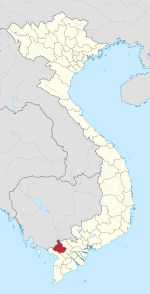
Ba Chúc
Appearance
You can help expand this article with text translated from the corresponding article in Vietnamese. (December 2024) Click [show] for important translation instructions.
|
Ba Chúc | |
|---|---|
 300 year old tree on Tượng Mountain, Ba Chúc town. | |
 | |
| Country | |
| Province | An Giang |
| District | Tri Tôn |
| Area | |
• Total | 7.94 sq mi (20.56 km2) |
| Population (2003) | |
• Total | 13,122 |
| • Density | 1,650/sq mi (638/km2) |
| Time zone | UTC+07:00 (Indochina Time) |
Ba Chúc is a town (thị trấn) of the Tri Tôn District of An Giang Province in Mekong Delta of Vietnam.
During the Vietnam War, the village came to the attention of American publics when it was revealed in The New York Times that civilians there had been forced by ARVN officers and their American advisers to remove landmines planted by Viet Cong and NVA units.[1]
In 1978 the village was the scene of the killing of an estimated 3,157 civilians by Khmer Rouge forces from neighbouring Cambodia in what became known as the Ba Chúc Massacre.[2]
Notes and references
- ^ Gloria Emerson, "Villagers Say Saigon Perils Their Lives", The New York Times, January 10, 1971, p. 1.
- ^ James Pringle, "MEANWHILE: When the Khmer Rouge came to kill in Vietnam," The New York Times, January 7, 2004.
10°30′N 104°54′E / 10.500°N 104.900°E

