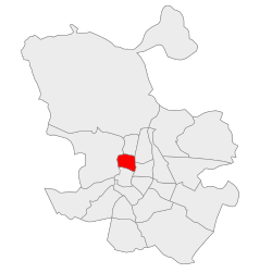
Chamberí
Appearance
Chamberí | |
|---|---|
 | |
 | |
| Country | Spain |
| Region | Community of Madrid |
| Municipality | Madrid |
| Government | |
| • Councillor-President | Jaime González Taboada (PP, 2023) |
| Area | |
| • Total | 4.69 km2 (1.81 sq mi) |
| Population | 145,934 |
| • Density | 31,029/km2 (80,360/sq mi) |
| Madrid district number | 7 |
 | |
Chamberí is a district of Madrid, Spain. It is further subdivided into six neighborhoods (Gaztambide, Arapiles, Trafalgar, Almagro, Ríos Rosas and Vallehermoso).[1] The district junta is headquartered at the plaza de Chamberí.[1] The current urban outline was born as part of the Ensanche plan drafted by Carlos María de Castro (approved in 1860).[2]
See also
- Chamberí (Madrid Metro)
- Church of San Fermín de los Navarros
- Beti Jai fronton
- Hospital of Maudes
- Geological and Mining Institute of Spain
- School of Mining Engineering of Madrid
- Sorolla Museum
References
- Citations
- ^ a b Pozo, Ángeles del (25 May 1987). "Chamberí: el de mayor densidad demográfica y con graves contrastes de viviendas". ABC. Madrid. p. 42.
- ^ Pallol Trigueros 2011, p. 5.
- Bibliography
- Pallol Trigueros, Rubén (2011). El Madrid moderno: Chamberí (el Ensanche Norte), símbolo del nacimiento de una nueva capital, 1860-1931 (PDF). Madrid: Universidad Complutense de Madrid. ISBN 978-84-694-6251-5.
External links
![]() Media related to Chamberí District at Wikimedia Commons
Media related to Chamberí District at Wikimedia Commons
40°25′58″N 3°41′50″W / 40.432792°N 3.697186°W
