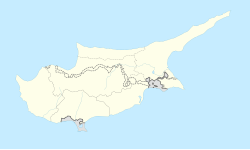
Fotta
Appearance
Fotta
| |
|---|---|
| Coordinates: 35°15′51″N 33°13′20″E / 35.26417°N 33.22222°E | |
| Country (de jure) | |
| • District | Kyrenia District |
| Country (de facto) | |
| • District | Girne District |
| Population (2011)[2] | |
• Total | 525 |

Fotta or Fota (Greek: Φώττα; Turkish: Dağyolu "mountain road", previously Fota) is a Turkish Cypriot village in the Kyrenia District of Cyprus. Fotta is under the de facto control of Northern Cyprus. As of 2011, it had a population of 525.
References
- ^ In 1983, the Turkish Republic of Northern Cyprus unilaterally declared independence from the Republic of Cyprus. The de facto state is not recognised by any UN state except Turkey.
- ^ "KKTC 2011 Nüfus ve Konut Sayımı" [TRNC 2011 Population and Housing Census] (PDF) (in Turkish). TRNC State Planning Organization. 6 August 2013. Archived from the original (PDF) on 2013-11-06.


