Oesman Sadik Airport
Appearance
This article includes a list of references, related reading, or external links, but its sources remain unclear because it lacks inline citations. (April 2024) |
Oesman Sadik Airport Bandar Udara Oesman Sadik | |||||||||||
|---|---|---|---|---|---|---|---|---|---|---|---|
| Summary | |||||||||||
| Operator | South Halmahera Government | ||||||||||
| Serves | Labuha | ||||||||||
| Location | Labuha, South Halmahera, North Maluku, Indonesia | ||||||||||
| Time zone | WIT (UTC+09:00) | ||||||||||
| Elevation AMSL | 7 ft / 2 m | ||||||||||
| Coordinates | 0°38′14.44″S 127°30′02.70″E / 0.6373444°S 127.5007500°E | ||||||||||
| Map | |||||||||||
 | |||||||||||
| Runways | |||||||||||
| |||||||||||
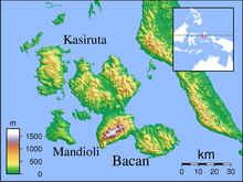
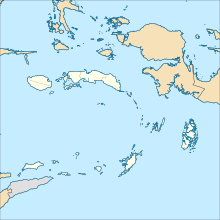
Oesman Sadik Airport (IATA: LAH, ICAO: WAEL) is located in Labuha, the capital city of South Halmahera Regency, North Maluku, Indonesia.
Airlines and destinations
| Airlines | Destinations |
|---|---|
| Wings Air | Manado,[a] Ternate |
- ^ Manado is continuation of Ternate flight as same flight number
Statistic
| Rank | Destinations | Frequency (weekly) | Airline(s) |
|---|---|---|---|
| 1 | Ternate, North Maluku | 14 | Wings Air |
| 2 | Ambon, Maluku | 7 | Wings Air |
References
- (in Indonesian) Dirjen Perhubungan Udara


