Oizon
Appearance
Oizon | |
|---|---|
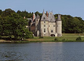
 The Château of La Verrerie | |
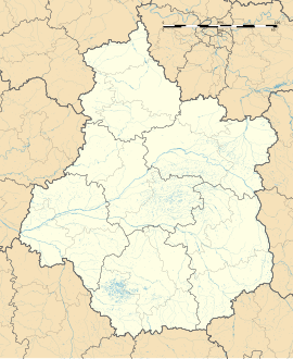
| Coordinates: 47°28′30″N 2°30′58″E / 47.475°N 2.5161°E | |
| Country | France |
| Region | Centre-Val de Loire |
| Department | Cher |
| Arrondissement | Vierzon |
| Canton | Aubigny-sur-Nère |
| Intercommunality | Sauldre et Sologne |
| Government | |
| • Mayor (2020–2026) | Jean-Marc Ruiz[1] |
Area 1 | 62.03 km2 (23.95 sq mi) |
| Population (2021)[2] | 667 |
| • Density | 11/km2 (28/sq mi) |
| Time zone | UTC+01:00 (CET) |
| • Summer (DST) | UTC+02:00 (CEST) |
| INSEE/Postal code | 18170 /18700 |
| Elevation | 184–326 m (604–1,070 ft) (avg. 250 m or 820 ft) |
| 1 French Land Register data, which excludes lakes, ponds, glaciers > 1 km2 (0.386 sq mi or 247 acres) and river estuaries. | |
Oizon (French pronunciation: [wazɔ̃]) is a commune in the Cher department in the Centre-Val de Loire region of France.
Geography
An area of streams, lakes, forestry and farming comprising the village and several hamlets situated some 26 miles (42 km) north of Bourges at the junction of the D923, D39, D213 roads and also on the D7, D89 and D21 roads. The rivers Nère and Oizenotte flow through the commune.
Population
| Year | Pop. | ±% |
|---|---|---|
| 1962 | 596 | — |
| 1968 | 701 | +17.6% |
| 1975 | 660 | −5.8% |
| 1982 | 725 | +9.8% |
| 1990 | 776 | +7.0% |
| 1999 | 752 | −3.1% |
| 2008 | 722 | −4.0% |
Sights
- The church of St. Martial, dating from the thirteenth century.
- Château de la Verrerie (Cher)
- A watermill.
See also
References
- ^ "Répertoire national des élus: les maires" (in French). data.gouv.fr, Plateforme ouverte des données publiques françaises. 13 September 2022.
- ^ "Populations légales 2021" (in French). The National Institute of Statistics and Economic Studies. 28 December 2023.
Wikimedia Commons has media related to Oizon.


