Saligny, Vendée
Appearance
Saligny | |
|---|---|
Part of Bellevigny | |
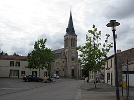
 The church in Saligny | |
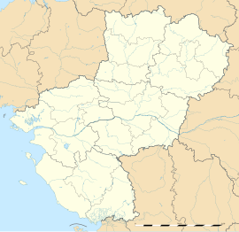
| Coordinates: 46°48′31″N 1°25′26″W / 46.8086°N 1.4239°W | |
| Country | France |
| Region | Pays de la Loire |
| Department | Vendée |
| Arrondissement | La Roche-sur-Yon |
| Canton | Aizenay |
| Commune | Bellevigny |
| Area 1 | 23.36 km2 (9.02 sq mi) |
| Population (2019)[1] | 2,087 |
| • Density | 89/km2 (230/sq mi) |
| Time zone | UTC+01:00 (CET) |
| • Summer (DST) | UTC+02:00 (CEST) |
| Postal code | 85170 |
| Elevation | 47–91 m (154–299 ft) |
| 1 French Land Register data, which excludes lakes, ponds, glaciers > 1 km2 (0.386 sq mi or 247 acres) and river estuaries. | |
Saligny (French pronunciation: [saliɲi]) is a former commune in the Vendée department in the Pays de la Loire region in western France. On 1 January 2016, it was merged into the new commune of Bellevigny.[2]
Education
There is one public school, École publique Sablier du Frêne, and one private school, École Primaire Privée Sacré Cœur, in Saligny. The public junior middle school Collège Antoine de Saint-Exupery is in nearby Belleville-sur-Vie.[3]
The Saligny community has a library; the media centre is in nearby Belleville-sur-Vie.[4]
See also
References
- ^ Téléchargement du fichier d'ensemble des populations légales en 2019, INSEE
- ^ Arrêté préfectoral 19 November 2015
- ^ "Écoles et collège." Bellevigny. Retrieved on 19 May 2018.
- ^ "Bibliothèque / Médiathèque." Bellevigny. Retrieved on 19 May 2018.
Wikimedia Commons has media related to Saligny (Vendée).


