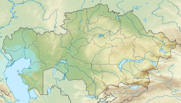
Sarykopa
| Sarykopa | |
|---|---|
| Сарықопа / Сарыкопа | |
 Sentinel-2 image of the lake in 2021. | |
| Location | Turgay Basin |
| Coordinates | 50°16′N 64°08′E / 50.267°N 64.133°E |
| Type | endorheic |
| Primary inflows | Saryozen and Teke |
| Catchment area | 985 square kilometers (380 sq mi) |
| Basin countries | Kazakhstan |
| Max. length | 26.7 kilometers (16.6 mi) to 53 kilometers (33 mi) |
| Max. width | 13.2 kilometers (8.2 mi) to 19 kilometers (12 mi) |
| Surface area | 184 square kilometers (71 sq mi) to 336 square kilometers (130 sq mi) |
| Max. depth | 3.5 meters (11 ft) |
| Surface elevation | 101.2 meters (332 ft) |
Sarykopa (Kazakh: Сарықопа; Russian: Сарыкопа) is a bittern salt lake in the Kostanay Region, Kazakhstan.[1]
Sarykopa lies in the steppe of the central sector of the Turgay Basin in Zhangeldi District, in the southern area of Kostanay Region. There are a number of villages near the lake.[2][3]
Geography
Sarykopa is an endorheic lake. Its shape is elongated, stretching roughly from SSW to NNE . The 164 kilometers (102 mi) long Saryozen river flows into the lake from the north and the Teke from the west. Since the lake is fed by snow its level is subject to variations according to the inflow, reaching a maximum area of 336 square kilometers (130 sq mi) in the spring floods when the snows melt. In years of significant snowfall the lake becomes a single body of water and its waters may flow out into the Turgay river through a channel close to Tauysh village in the south, but such periods are very few and far between.[4]
Usually the surface of the lake stays around 184 square kilometers (71 sq mi) in the more common periods of low water where Sarykopa, especially in the summer, breaks up into a cluster of separate lakes with no connection between them. The depth fluctuates between 1 meter (3 ft 3 in) and 3 meters (9.8 ft).[5] The western banks are gently-sloping, while the eastern shore rises steeply up to between 5 meters (16 ft) to 10 meters (33 ft) cliff-like banks.[6][2]
Fauna
Sarykopa is a refuge for birds such as the white-tailed lapwing, steppe gull, slender-billed curlew and the great white pelican, as well as the critically endangered siberian crane,[5] but the effects of human action on the lake are unfavorable for wildlife.[3]
See also
References
- ^ "M-41 Topographic Chart (in Russian)". Retrieved 24 July 2022.
- ^ a b Google Earth
- ^ a b Sarykopa Lake System
- ^ Kazakhstan National Encyclopedia / Ch. ed. B.O. Jakyp. — Almaty: « Kazakh encyclopedia» ZhSS, 2011. ISBN 9965-893-64-0 (T.Z.), ISBN 9965-893-19-5
- ^ a b Sites with great importance for the Siberian Crane
- ^ Сарыкопа; Great Soviet Encyclopedia in 30 vols. — Ch. ed. A.M. Prokhorov. - 3rd ed. - M. Soviet Encyclopedia, 1969-1978. (in Russian)

