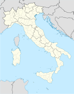
Aosta
Aspetto
| Aosta / Aoste comune tagliàne | |||
|---|---|---|---|
 | |||
| |||
| State | |||
| Reggione | |||
| Provinge | |||
| Coordinate | 45°44′14″N 7°19′14″E | ||
| Altitudine | 583 m s.l.m. | ||
| Superficie | 21,37 km² | ||
| Crestiàne | 34 631 (2007) | ||
| Denzetà | 1620,54 cr./km² | ||
| Fraziune | Arpuilles, Cache, Champailler, Cossan, Entrebin, Excenex, Laravoire, Porossan, Seyssinod, Signayes, Vignole | ||
| Comune 'nzeccate | Charvensod, Gignod, Gressan, Pollein, Roisan, Saint-Christophe, Sarre | ||
| CAP | 11100 | ||
| Prefisse | 0165 | ||
| Codece ISTAT | 007003 | ||
| Cod. catastale | A326 | ||
| Nome javetande | aostani o aostois | ||
| Patrone | San Grato | ||
| Sciurne festive | 7 settembre | ||
| Site istituzionale | |||
Aosta éte 'nu comune tagliáne de 34.610 crestiáne.
Otre pruggette
 Uicchimedie Commons tène files multimediale sus Aosta
| Condrolle de autorità | VIAF (EN) 123927631 · ISNI (EN) 0000 0001 2242 5737 · SBN (IT, EN) PUVL000155 · BAV (EN, IT, JA) 494/13329 · LCCN (EN) n79063211 · GND (DE) 4079805-7 · BNE (ES) XX459274 (data) · BNF (FR) cb11946285w (data) · J9U (EN, HE) 987007564217605171 |
|---|
Valle d'Aosta Comune d'a Provinge de Aosta
| Allein · Antey-Saint-André · Aosta · Arnad · Arvier · Avise · Ayas · Aymavilles · Bard · Bionaz · Brissogne · Brusson · Challand-Saint-Anselme · Challand-Saint-Victor · Chambave · Chamois · Champdepraz · Champorcher · Charvensod · Châtillon · Cogne · Courmayeur · Donnas · Doues · Emarèse · Etroubles · Fontainemore · Fénis · Gaby · Gignod · Gressan · Gressoney-La-Trinité · Gressoney-Saint-Jean · Hône · Introd · Issime · Issogne · Jovençan · La Magdeleine · La Salle · La Thuile · Lillianes · Montjovet · Morgex · Nus · Ollomont · Oyace · Perloz · Pollein · Pont-Saint-Martin · Pontboset · Pontey · Pré-Saint-Didier · Quart · Rhêmes-Notre-Dame · Rhêmes-Saint-Georges · Roisan · Saint-Christophe · Saint-Denis · Saint-Marcel · Saint-Nicolas · Saint-Oyen · Saint-Pierre · Saint-Rhémy-en-Bosses · Saint-Vincent · Sarre · Torgnon · Valgrisenche · Valpelline · Valsavarenche · Valtournenche · Verrayes · Verrès · Villeneuve |
Categorije:
- Pagine con argomenti di formatnum non numerici
- Stub
- P625 uguale sus Uicchidate
- Prefisso telefonico locale uguale a Wikidata
- Codice ISTAT uguale a Wikidata
- P41 lette da Uicchidate
- P94 differende sus Uicchidate
- P281 uguale sus Uicchidate
- P806 uguale sus Uicchidate
- P856 uguale sus Uicchidate
- P2044 uguale sus Uicchidate
- P2046 differende sus Uicchidate
- Comune d'a Valle d'Aosta
- Comune d'a provinge de Aosta
- Pàggene cu le mappe


