Angera
Appearance
Angera | |
|---|---|
| Città di Angera | |
 | |
 | |
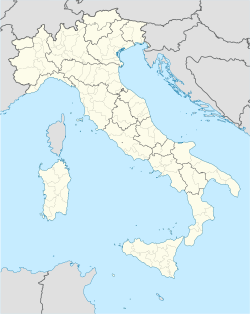
| Coordinates: 45°46′N 08°35′E / 45.767°N 8.583°E | |
| Kintra | Italy |
| Region | Lombardy |
| Province | Varese (VA) |
| Frazioni | Capronno, Barzola |
| Area | |
| • Total | 17 km2 (7 sq mi) |
| Elevation | 193 m (633 ft) |
| Population (31 December 2004) | |
| • Total | 5,713 |
| • Density | 340/km2 (870/sq mi) |
| Demonym(s) | Angeresi |
| Time zone | UTC+1 (CET) |
| • Summer (DST) | UTC+2 (CEST) |
| Postal code | 21021 |
| Diallin code | 0331 |
| Patron saunt | Santa Maria Assunta |
| Saunt day | 15 August |
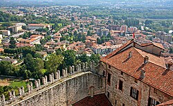
Angera is a toun an comune locatit in the province o Varese, in the Lombardy region o northren Italy. In Roman times, unner the name o Angleria, it wis an important loch port an road station. Angera receivit the title o ceety bi Duke Ludovico il Moro o 7 October 1497. The day its major featur is the Rocca, an imposin castle o vera auncient oreegin. The aurie affers guid wines an luvely panoramas ower Loch Maggiore.
Notable Angeresi
[eedit | eedit soorce]- Peter Martyr d'Anghiera (1457–1526), historian o Spain.
- Cristoforo Solari cried il Gobbo (c.1460–1527), sculptor an airchitect.
Freemit airtins
[eedit | eedit soorce]


