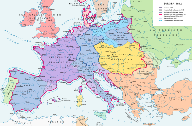
Size of this preview: 800 × 526 pixels. Other resolutions: 320 × 211 pixels | 640 × 421 pixels | 1,024 × 674 pixels | 1,280 × 842 pixels | 2,284 × 1,503 pixels.
Original file (2,284 × 1,503 pixels, file size: 1.13 MB, MIME type: image/png)
File history
Click on a date/time to view the file as it appeared at that time.
| Date/Time | Thumbnail | Dimensions | User | Comment | |
|---|---|---|---|---|---|
| current | 15:25, 11 September 2016 |  | 2,284 × 1,503 (1.13 MB) | KaterBegemot | Border corrections at Thorn and Tarnopol area, minor kerning and positioning changes, smaller font at Swedish Pomerania |
| 00:48, 20 July 2016 |  | 2,284 × 1,503 (1.14 MB) | KaterBegemot | Added Bukovina / Marked Corfu as territory under French influence (red) / Correct position of city points of Basel, Geneva, Toulouse / Minor border corrections / Better kerning / Thinner map legend border | |
| 00:23, 14 July 2016 |  | 2,284 × 1,503 (1.13 MB) | KaterBegemot | Added P. of Neuchatel, Ekaterinoslav, Varna, Brăila / Corrected borders of Montenegro, Milan-Genoa area / Deleted border of map | |
| 21:33, 5 October 2013 |  | 2,293 × 1,512 (1 MB) | KaterBegemot | Corrected boundaries of Switzerland, Prussia and Circassia | |
| 17:56, 16 September 2012 |  | 2,293 × 1,512 (1 MB) | KaterBegemot | Minor fixes | |
| 15:50, 10 September 2012 |  | 2,293 × 1,512 (1 MB) | KaterBegemot | Corrections | |
| 16:31, 8 September 2012 |  | 2,293 × 1,512 (1,019 KB) | KaterBegemot | == {{int:filedesc}} == {{Information |Description= {{de|1=Europa 1812. Politische Ausgangslage vor Napeoleons Russlandfelzug.}}{{en|1=Europe in 1812. Political situation before Napoleon's Russian Campaign.}} |Source={{Own}}. Source of Information: </br... |
File usage
The following page uses this file:
Global file usage
The following other wikis use this file:
- Usage on de.wikipedia.org
- Usage on eu.wikipedia.org
- Usage on zh.wikipedia.org
