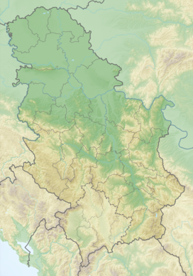
Greben[1][2] (Cyrillic: Гребен, meaning "ridge" or literally "comb") is a mountain in southeastern Serbia, with a small section of the southwestern ridge in Bulgaria. It is named after a large karst ridge that runs along its spine.[citation needed] Greben rises near the village of Poganovo in Serbia, in the municipality of Dimitrovgrad, and extends southeast towards the Bulgarian village of Vrabcha. Prior to the Treaty of Neuilly of 1919, after the First World War, the area was part of Bulgaria.
| Greben | |
|---|---|
 View from Dragovski kamak (1,118 m) in the Bulgarian part of Greben | |
| Highest point | |
| Elevation | 1,338 m (4,390 ft)[1] |
| Coordinates | 42°56′54″N 22°38′29″E / 42.94833°N 22.64139°E |
| Geography | |
| Location | Serbia / Bulgaria |
Its highest peak Beženište (or Dziglina livada) stands at an elevation of 1,338 meters above sea level. The highest peak that falls within Bulgaria is Dragovski kamak (Драговски камък), at 1,118 m. Due to the characteristic pyramidal shape of its north face, Dragovski kamak is referred to as the "Matterhorn of Tran".[3]
With nearby Vlaška planina, Greben forms the attractive canyon (Poganovsko ždrelo) of the Jerma (Erma) river.[4]
Greben Hill in the Antarctica was named after the mountain by the Bulgarian Antarctic Place-names Commission.[5]
Gallery
editReferences
edit- ^ a b Jovan Đokić. "Katalog planina Srbije". PSD Kopaonik Beograd. Archived from the original on 2011-05-18.
- ^ "Kanjon Jerme – I dan, Greben planina". PEK "Gora" Kragujevac. Retrieved 2010-10-11.
- ^ Цветанов, Момчил (2014). Българските планини (in Bulgarian). Домино. ISBN 9789546512499.
- ^ Strategija zajedničkog razvoja graničnih opština u oblasti Sofije i okruga Pirot (PDF), 2005 Susedski program Bugarska – Srbija, Joint Small Project Fund, p. 17[permanent dead link]
- ^ Antarctic Place-names Commission of Bulgaria
External links
edit- Photo tour over Greben Archived 2011-07-06 at the Wayback Machine (in Bulgarian)
