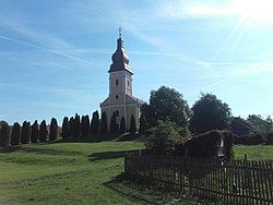
Baktakék
Appearance
From Wikipedia, the free encyclopedia
This is an old revision of this page, as edited by YoungstownToast (talk | contribs) at 21:35, 28 February 2022 (added Category:Rusyn villages using HotCat). The present address (URL) is a permanent link to this revision, which may differ significantly from the current revision.
Revision as of 21:35, 28 February 2022 by YoungstownToast (talk | contribs) (added Category:Rusyn villages using HotCat)
Place in Borsod-Abaúj-Zemplén, Hungary
Baktakék | |
|---|---|
 | |
| Coordinates: 48°22′09″N 21°01′44″E / 48.36930°N 21.02888°E / 48.36930; 21.02888 | |
| Country | |
| County | Borsod-Abaúj-Zemplén |
| Area | |
• Total | 18.79 km2 (7.25 sq mi) |
| Population (2004) | |
• Total | 744 |
| • Density | 39.59/km2 (102.5/sq mi) |
| Time zone | UTC+1 (CET) |
| • Summer (DST) | UTC+2 (CEST) |
| Postal code | 3836 |
| Area code | 46 |
Baktakék is a village in Borsod-Abaúj-Zemplén county, Hungary.
External links
- Street map (in Hungarian)
This Borsod-Abaúj-Zemplén location article is a stub. You can help Wikipedia by expanding it. |
Retrieved from "https://en.wikipedia.org/w/index.php?title=Baktakék&oldid=1074557146"


