Nieuwe Wetering
Appearance
Nieuwe Wetering | |
|---|---|
Village | |
 Farm in Nieuwe Wetering | |
| Coordinates: 52°12′N 4°37′E / 52.200°N 4.617°E | |
| Country | Netherlands |
| Province | South Holland |
| Municipality | Kaag en Braassem |
| Area | |
| • Total | 0.45 km2 (0.17 sq mi) |
| Elevation | −0.8 m (−2.6 ft) |
| Population (2021)[1] | |
| • Total | 640 |
| • Density | 1,400/km2 (3,700/sq mi) |
| Time zone | UTC+1 (CET) |
| • Summer (DST) | UTC+2 (CEST) |
| Postal code | 2376[1] |
| Dialing code | 071 |
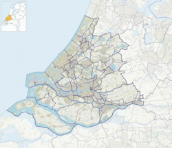
Nieuwe Wetering is a village in the Dutch province of South Holland. It is a part of the municipality of Kaag en Braassem, and lies about 10 km east of Leiden.
The village was first mentioned in 1343 as "Nuwe Weteringhe", and means "new waterway". Nieuwe (new) has been added to distinguish from Oude Wetering.[3]
References
[edit]- ^ a b c "Kerncijfers wijken en buurten 2021". Central Bureau of Statistics. Retrieved 4 May 2022.
- ^ "Postcodetool for 2376AD". Actueel Hoogtebestand Nederland (in Dutch). Het Waterschapshuis. 24 July 2019. Retrieved 4 May 2022.
- ^ "Nieuwe Wetering - (geografische naam)". Etymologiebank (in Dutch). Retrieved 4 May 2022.


