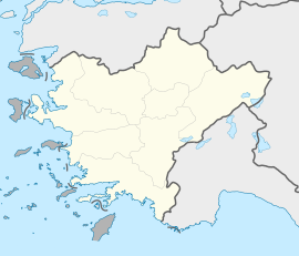
Kocabaş
Appearance
Kocabaş | |
|---|---|
| Coordinates: 37°49′N 29°19′E / 37.817°N 29.317°E | |
| Country | Turkey |
| Province | Denizli |
| District | Honaz |
| Elevation | 445 m (1,460 ft) |
| Population (2022) | 934 |
| Time zone | UTC+3 (TRT) |
| Postal code | 20330 |
| Area code | 0258 |
Kocabaş is a neighbourhood of the municipality and district of Honaz, Denizli Province, Turkey.[1] Its population is 934 (2022).[2] Before the 2013 reorganisation, it was a town (belde).[3][4]
It is situated in the plains of Büyük Menderes River (historical Maeander). The distance to Honaz is 12 kilometres (7.5 mi) and to Denizli is 26 kilometres (16 mi). Although the fertile area round Kocabaş was always populated in the historical ages, the town in the open plains is a relatively recent settlement probably because of the security reasons.[5]
References
[edit]- ^ Mahalle, Turkey Civil Administration Departments Inventory. Retrieved 12 July 2023.
- ^ "Address-based population registration system (ADNKS) results dated 31 December 2022, Favorite Reports" (XLS). TÜİK. Retrieved 12 July 2023.
- ^ "Law No. 6360". Official Gazette (in Turkish). 6 December 2012.
- ^ "Classification tables of municipalities and their affiliates and local administrative units" (DOC). Official Gazette (in Turkish). 12 September 2010.
- ^ "Mayor's pahe {{in lang|tr}}". Archived from the original on 2011-11-19. Retrieved 2011-11-04.


