Ko Pha-ngan Airport
This article needs additional citations for verification. (October 2012) |
Ko Pha-ngan Airport | |||||||||||
|---|---|---|---|---|---|---|---|---|---|---|---|
| Summary | |||||||||||
| Airport type | Public | ||||||||||
| Owner | Kan Air | ||||||||||
| Operator | Kan Air | ||||||||||
| Serves | Ko Pha-ngan | ||||||||||
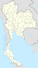
| Location | Ko Pha-ngan, Surat Thani Province, Thailand | ||||||||||
| Hub for | |||||||||||
| Coordinates | 9°44′15″N 100°04′45″E / 9.7375°N 100.0792°E | ||||||||||
| Map | |||||||||||
 | |||||||||||
| Runways | |||||||||||
| |||||||||||
Ko Pha-ngan Airport is an unfinished airport that was under construction in 2012–2015 on Ko Pha-ngan, Surat Thani Province, Thailand.[1] The airport was being built by Kan Air, a domestic Thai airline, who were reportedly spending 700-900 million baht.[2][3] Kan Air planned to introduce flights to Ko Pha-ngan's neighboring islands, Ko Samui and Ko Tao, as well as three 80-minute flights daily to and from Bangkok's Don Mueang Airport.[3] Construction was suspended indefinitely due to alleged illegal encroachment of National Park land.
Construction
[edit]The airport was scheduled for completion in September 2014. Construction was halted in 2015 when authorities claimed that the airport had infringed on a 20 rai portion of Than Sadet-Ko Pha-ngan National Park.[4] In 2015 the area for the runway was cleared of trees and flattened and there has been no further construction since then. [5]
In 2016, Kan Air announced that they are seeking a capital injection of 1.5 billion baht to complete the airport.[6] The airport's developer reportedly spent 2 billion Thai baht on the unfinished construction.[7]
Construction works have finally been terminated, because of illegal national park land encroachment.
Features
[edit]The airport was projected to have a capacity of 600,000 passengers per year.[8] The site for the airport, with a 1,100-metre runway and thatched-roof terminal, is on the eastern side of the island. Ko Pha-ngan Airport will be open to other operators, with the same parking and landing fees as at Suvarnabhumi Airport.
If completed, the airport will provide direct air access to Ko Pha-ngan for the first time. Currently the only transportation route to Ko Pha-ngan is via ferry. The nearest airport is Samui Airport on the larger Ko Samui to the south.
References
[edit]- ^ Kositchotethana, Boonsong (2012-10-16). "Kan Air ready for take-off". Bangkok Post. Retrieved 30 August 2016.
- ^ "Koh Phangan airport could be open a soon as next year". Samui Times. n.d. Retrieved 13 November 2016.
- ^ a b Hiufu Wong, Maggie (2012-10-18). "Party island Koh Phangan to build its first airport". CNN. Retrieved 13 November 2016.
- ^ Chaolan, Supapong (2015-09-30). "Phangan airport encroaches on forest: officials". Bangkok Post. Retrieved 30 August 2016.
- ^ "Will Construction on Koh Phangan Airport Continue? – Koh Phangan Airport".
- ^ PCL., Post Publishing. "Bangkok Post article". Bangkok Post. Retrieved 2017-04-07.
- ^ "Koh Phangan Airport is still on – Koh Phangan Airport".
- ^ "Koh Phangan Airport". CAPA Centre for Aviation. Retrieved 30 August 2016.
External links
[edit] Ko Pha Ngan travel guide from Wikivoyage
- Ko Pha-ngan Airport
- http://kohphangannews.org/high-alert/koh-phangan-airport-construction-suspended-2160.html
- http://www.bangkokpost.com/business/tourism-and-transport/713280/phangan-airport-encroaches-on-forest-officials

