Sei Pakning Airport
Appearance
Sei Pakning Airport | |||||||||||
|---|---|---|---|---|---|---|---|---|---|---|---|
| Summary | |||||||||||
| Airport type | Private | ||||||||||
| Serves | Sungai Pakning | ||||||||||
| Location | Sungai Pakning, Bengkalis Regency, Riau Province, Indonesia | ||||||||||
| Elevation AMSL | 12 ft / 4 m | ||||||||||
| Coordinates | 01°22′11″N 102°08′24″E / 1.36972°N 102.14000°E | ||||||||||
| Maps | |||||||||||
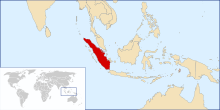
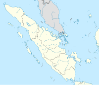
 Sumatra region in Indonesia | |||||||||||
 | |||||||||||
| Runways | |||||||||||
| |||||||||||
Sei Pakning Airport[1] or Sei Selari Airport (IATA: SEQ, ICAO: WIBS) is a domestic airport located in Sungai Pakning, Bengkalis Regency, Riau Province, Indonesia. It serves the town of Sungai Pakning.[1] The airport served charter flights for Pertamina. Currently, there are no flights to and from this airport.
References
[edit]- ^ a b c "Airline and Airport Code Search". IATA. Retrieved 13 April 2016.
- ^ Google Maps - airport location

