Wilhelmshaven Power Station
Appearance
You can help expand this article with text translated from the corresponding article in German. (July 2012) Click [show] for important translation instructions.
|
| Wilhelmshaven Power Station (E.ON) | |
|---|---|
 Aerial view of the power station (May 2012) | |
 | |
| Country | Germany |
| Location |
|
| Coordinates | 53°33′52.4″N 8°8′47″E / 53.564556°N 8.14639°E |
| Commission date | 1976 |
| Operator | Uniper |
| Thermal power station | |
| Primary fuel | Fossil Fuel: Coal |
| Power generation | |
| Nameplate capacity | 756 MW |
| External links | |
| Commons | Related media on Commons |
The Wilhelmshaven Power Station is one of two coal power stations in the city of Wilhelmshaven, Germany. Built in the middle of the 1970s, the power station has an output of 747 megawatts.
-
The Power Station seen from West
-
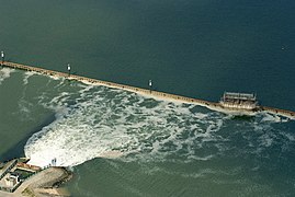
Run-off water in the Jade Bight
-
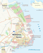
Map
External links
[edit] Media related to Wilhelmshaven Power Station (E.ON) at Wikimedia Commons


