Brezje, Zagorje ob Savi
Appearance
Brezje | |
|---|---|
 Brezje seen from the northwest | |
| Coordinates: 46°10′43.84″N 14°55′28.62″E / 46.1788444°N 14.9246167°E | |
| Country | |
| Traditional region | Upper Carniola |
| Statistical region | Central Sava |
| Municipality | Zagorje ob Savi |
| Area | |
| • Total | 2.26 km2 (0.87 sq mi) |
| Elevation | 643.2 m (2,110.2 ft) |
| Population (2002) | |
| • Total | 143 |
| [1] | |
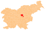
Brezje (pronounced [ˈbɾeːzjɛ]) is a settlement north of Izlake in the Municipality of Zagorje ob Savi in central Slovenia. The area is part of the traditional region of Upper Carniola. It is now included with the rest of the municipality in the Central Sava Statistical Region.[2]
Name
[edit]Brezje was attested in written sources as Pirkch in 1433 and Bresya in 1485, among other spellings.[3]
Cultural heritage
[edit]A small Neo-Gothic chapel-shrine at the crossroads in the centre of the settlement is dedicated to the Virgin Mary. It dates to 1890 and was renovated in 1997.[4]
References
[edit]- ^ Statistical Office of the Republic of Slovenia
- ^ Zagorje ob Savi municipal site Archived 2012-03-06 at the Wayback Machine
- ^ "Brezje". Slovenska historična topografija. ZRC SAZU Zgodovinski inštitut Milka Kosa. Retrieved October 4, 2021.
- ^ Slovenian Ministry of Culture register of national heritage reference number ešd 14013
External links
[edit]


