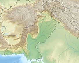
Kush (mountain)
Appearance
| Kush | |
|---|---|
| Highest point | |
| Elevation | 2,527 m (8,291 ft) |
| Coordinates | 28°49′1.7″N 66°34′2.7″E / 28.817139°N 66.567417°E |
| Geography | |
| Location | Balochistan, Pakistan |
| Parent range | Toba Kakar Range |
Kush (Balochi: کش, kill) is a mountain near Kalat, Pakistan.[1] It is located not far from the similarly named Kushi mountain.[citation needed]
References
[edit]- ^ Syed Ramsey (February 2017). Balochistan: In Quest of Freedom. VIJ Books (India) PVT Limited. ISBN 978-9-38-683439-3. [failed verification]

