Miķeļtornis
Appearance
This article needs additional citations for verification. (December 2006) |
Miķeļtornis
Livonian: Pizā | |
|---|---|
Village | |
 Lighthouse and church in Miķeļtornis | |
| Coordinates: 57°36′00″N 21°58′00″E / 57.60000°N 21.96667°E | |
| Country | |
| Municipality | Ventspils municipality |
| Parish | Tārgale parish |
| Elevation | 13 ft (4 m) |
| Population (2015) | |
• Total | 30 |
| Time zone | UTC+2 (EET) |
| • Summer (DST) | UTC+3 (EEST) |
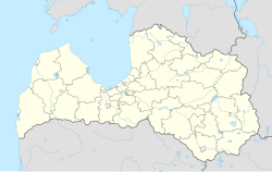
Miķeļtornis (Livonian: Pizā) is a populated place in Tārgale parish, Ventspils municipality, Latvia.[1] It is one of the twelve Livonian villages on the Livonian Coast.
Miķeļbāka
[edit]Lighthouse "Miķeļbāka" established in 1884 is located nearby. The present 184-foot-high (56 m) lighthouse tower was built in 1957. It is the highest lighthouse in the three Baltic states, and is located about 7.5 miles west of Lielirbe at 57°36′N, 21°53′E.
See also
[edit]References
[edit]External links
[edit]Wikimedia Commons has media related to Miķeļtornis.

