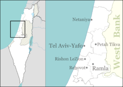
Ganei Tal
Appearance
Ganei Tal | |
|---|---|
 | |
| Coordinates: 31°47′19″N 34°47′32″E / 31.78861°N 34.79222°E | |
| Country | Israel |
| District | Central |
| Council | Nahal Sorek |
| Affiliation | Hapoel HaMizrachi |
| Founded | 2010 |
| Founded by | Former Israeli settlers |
| Population (2022)[1] | 923 |
Ganei Tal (Hebrew: גני טל, lit. Gardens of Dew) is a moshav in central Israel. Located to the south of Gedera, it falls under the jurisdiction of Nahal Sorek Regional Council. In 2022 it had a population of 923.[1]
History
[edit]The village was established in 2010 by former settlers who had been removed from the Gaza Strip as a result of the disengagement plan and who had been temporarily housed in Yad Binyamin. Built next to Hafetz Haim, it was named after the former settlement of the same name.
References
[edit]- ^ a b "Regional Statistics". Israel Central Bureau of Statistics. Retrieved 21 March 2024.

