
Concession Street (Hamilton, Ontario)

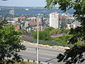
Concession Street is an Upper City (mountain) arterial road in Hamilton, Ontario, Canada. It starts at Belvidere Avenue, just West of Sam Lawrence Park, and extends eastward past Mountain Drive Park on Upper Gage Street and ends shortly thereafter at East 43rd Street. (Note: East of East 43rd Street the road is known as Mountain Brow Road.)
History


Concession Street, is the oldest settlement area on the Hamilton mountain. It was once an African American neighbourhood settled by slaves escaping the U.S. via the underground railroad[1]. This part of Hamilton Mountain was then known as, "Little Africa". Canada in general and Hamilton in particular received these refugees with great sympathy and understanding. They were illiterate and took up education in the "Mission", a union church and school building, erected in 1860. The adults would sit in with the children and spell out words and hoped that they might some day be able to read the Bible. They also liked to display pictures of Queen Victoria alongside that of Abraham Lincoln. They also took on new surnames to avoid being identified and recaptured. Many of the families there favoured the name "Johnson" as well as "Atkins", "Murdoch" and "Green". Over the years these families abandoned the homes they had established, to be seen no more on the hilltop. They didn't like the long cold winters and eventually returned back to the United States. [1] Today it is a predominantly white neighbourhood.
Originally known as Stone Road and changed to Concession Street in 1909. As well, the Hamilton mountain was a separate community from the Lower city Hamilton and known as "Mount Hamilton" but by 1891, properties north of Concession Street were annexed by the city of Hamilton and were serviced with water, sewers and sidewalks. Note: Aberdeen Avenue in the Lower City was originally known as Concession Street. [2]
The Jolley Cut, (named after James Jolley, (1813-1892), saddler, harnessmaker, politician) is a mountain/lower city-access road in Hamilton. James Jolley funded construction of the Jolley Cut. [3]
The Henderson General Hospital got it's name in 1954 when it was named after Nora-Francis Henderson who was the first woman on Hamilton City Council and also the first city controller in Canada. She was also a journalist and activist who pushed for children's and women's rights + health care. The hospital is currently (April 2007) going through with some major renovations and expansion and once complete the hospital will be renamed the Juravinski Hospital and Cancer Centre, (after Charles Juravinski and his wife Margaret), after they both made a $43-million contribution to health care in Hamilton. Charles Juravinski sold Flamboro Downs racetrack (Canada's fastest half-mile harness horse racing track)[4] in 2002 and chose to share the money with Hamilton city hospitals. The new hospital will have a Henderson wing. [5]
Joslin's Karate and Kickboxing Studio is owned by 3 time Canadian heavyweight Karate champion Rick Joslin. Joslin's Karate & Kickboxing Studios is located at 436 Concession street. Past & current clients include Hamilton Bulldogs AHL hockey players, including NHL tough guy Georges Laraque. In 2007, the gym was ranked #1 in Canada and #4 in the World. His son Jeff Joslin, nicknamed "The Inferno", is a Mixed Martial Arts Fighter. [6]
Landmarks


Note: Listing of Landmarks from West to East.
- Sam Lawrence Park
- Jolley Cut/ Arkeldun Ave., (mountain/ lower city access road)
- Hamilton Mountain Seventh-Day Adventist Church
- Joslin's Karate & Kickboxing Studio
- Concession Medical Pharmacy
- George L. Armstrong Elementary School
- Mountain Lanes (bowling alley), Upper Wentworth near Concession Street
- Concession Wentworth Medical Clinic Inc.
- The Movie Palace (theatre)
- Royal Bank building
- Concession Library
- Zarky's Fine Foods
- The Cancer Assistance Program House
- St. Stephen on the Mount (church)
- La Luna on the Mountain (restaurant)
- Henderson Research Centre
- Juravinski Cancer Centre
- Henderson General Hospital
- Grand Health Academy-Training Centre
- Sherman Cut, (a road that travels underneath Concession Street)
- Big Bear Food Mart
- Mountain Drive Park
Communities
Note: Listing of neighbourhoods from West to East. [7]
Roads that are parallel with Concession Street
Lower City Roads:
- Burlington Street, West/East
- Barton Street, West/East
- Cannon Street, West/East
- Wilson Street
- King William Street
- King Street, West/East
- Main Street, West/East - Queenston Road
- Jackson Street, West/East
- Hunter Street, West/East
- Augusta Street
- Charlton Avenue, West/East
- Aberdeen Avenue
Niagara Escarpment (Mountain) Roads:
- Concession Street
- Fennell Avenue, West/East
- Mohawk Road, West/East
- Limeridge Road West/East
- Lincoln M. Alexander Parkway - Mud Street, (Hamilton City Road 11)
- Stone Church Road, West/East
 ; Rymal Road, West/East
- Twenty Road
Roads that cross Concession Street
Note: Listing of streets from West to East.
Images
-
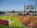 Sam Lawrence Park
 -
 Sam Lawrence Park
 -
 Sam Lawrence Park


References
- ^ Burkholder, Mabel (1956). Barton on the Mountain. Hamilton Public Library.
{{cite book}}: Check date values in:|year=(help)CS1 maint: year (link) - ^ Houghton, Margaret (2002). Hamilton Street Names: An Illustrated Guide. James Lorimer & Co. Ltd. ISBN 1-55028-773-7.
{{cite book}}: Check date values in:|year=(help)CS1 maint: year (link) - ^ Bailey, Thomas Melville (1981). Dictionary of Hamilton Biography (Vol I, 1791-1875). W.L. Griffin Ltd.
{{cite book}}: Check date values in:|year=(help)CS1 maint: year (link) - ^ "Flamboro Downs". Official web site. Retrieved 2007-04-21.
- ^ "StreetBeat: "Mr. Generosity"" (Press release). The Hamilton Spectator. 2007-04-20.
{{cite press release}}:|access-date=requires|url=(help); Check date values in:|date=(help) - ^ "Official Web Site: Jeff Joslin". Retrieved 2007-04-21.
- ^ "Hamilton Neighbourhood Boundaries, (map.hamilton.ca)" (PDF). Retrieved 2007-05-11.
- Concession Street B.I.A.
- Niagara Escarpment Commission (NEC) Official web site
- MapArt Golden Horseshoe Atlas - Page 647 - Grids H12, H13, H14, H15
- Google Maps: Concession Street (Hybrid)