
Algonquin Provincial Park
| Algonquin Provincial Park | |
|---|---|
IUCN category IV (habitat/species management area) | |
| Location | Ontario, Canada |
| Nearest city | Huntsville, Ontario |
| Area | 7725.0 km² |
| Established | 1893 |
| Visitors | 800,000 to 1 million persons per year |
| Governing body | Ontario Parks |
Algonquin Provincial Park is a provincial park located between Georgian Bay and the Ottawa River in central Ontario. It is the first provincial park in Canada having been established in 1893. It covers about 7,725 square kilometres. Its size, combined with its proximity to the major urban centres of Toronto and Ottawa make it one of the most popular parks in the province. Highway 60 runs through the south of the park, while the Trans-Canada Highway bypasses it to the north. Over 2400 lakes and 1200 kilometres of streams and rivers are located within the park, including Canoe Lake and the Petawawa, Nipissing, Amable du Fond, Madawaska, and Tim rivers. These were formed by the retreat of the glaciers during the last ice age.
Algonquin Park was named a national historic site in 1992 in recognition of several heritage values, including: its role in the development of park management; pioneering visitor interpretation programs later adopted by national and provincial parks across the country; its role in inspiring artists, which in turn gave Canadians a greater sense of their country; and historic structures such as lodges, hotels, cottages, camps, entrance gates, a railroad station, and administration and museum buildings.
The park is in an area where there is a transition between northern coniferous forest and southern deciduous forest. Because of this unique mixture of forest types, the park contains thousands of species of plants and animals. Animals include moose, beaver, black bear, raccoon, porcupine, red squirrel, eastern gray squirrel, eastern chipmunks, mink, marten, otter, fisher, lynx, skunk, meadow vole, eastern Canadian wolf, white tailed deer, lake trout, brook trout, walleye (yellow pickerel), smallmouth bass, fresh water ling, whitefish, rock bass, yellow perch, pumpkinseed sunfish, northern pike, muskellunge and freshwater sculpin. Major tree species include eastern white pine, red pine, jack pine, tamarack, white spruce, black spruce, sugar maple, red oak, white birch and yellow birch. It is an important site for wildlife research.
Park creation
In the 19th century, the logging industry harvested the large white pine and red pine trees, to produce lumber for domestic and American markets, as well as square timber for export to Great Britain. They were followed by small numbers of Homesteaders and farmers. But the area's beauty was also recognized by nature preservationists.
In order to manage these conflicting interests, the Ontario Government appointed a commission to inquire into and report on the matter. The act to establish Algonquin Park was drawn up in 1892 by this five member Royal Commission, made up of Alexander Kirkwood (the chairman and Commissioner of Crown Lands), James Dickson (Ontario Land Surveyor), Archibald Blue (director of mines), Robert Phipps (head of the Forestry Branch), and Aubrey White (Assistant Commissioner of Crown Lands). Their report recommended that the park should be established in the territory lying near and enclosing the headwaters of five major rivers, those being: the Muskoka, Madawaska (including Opeongo), Amable du Fond, Petawawa and South rivers.

The commissioners remarked in their report: "the experience of older countries had everywhere shown that the wholesale and indiscrimate slaughter of forests brings a host of evils in its train. Wide tracts are converted from fertile plains into arid desert, springs and streams are dried up, and the rainfall, instead of percolating gently through the forest floor and finding its way by easy stages by brook and river to the lower levels, now descends the valley in hurrying torrents, carrying before it tempestuous floods."
Although much of the area within Algonquin had been under licence for some time, it was intended to make the Park an object lesson in forestry, the land being yet well timbered with pine and hardwoods. Under the act, only licences to cut pine would be issued for limits within the park. Although the commissioners had recommended that when the hardwood was mature, it too should be cut.
An Act to establish "Algonquin National Park of Ontario" was passed by the Ontario Legislature, May 23, 1893(56 Vic.,c.8). However, the park has always been under the jurisdiction of the provincial government. No provincial parks existed until Algonquin, but there was a new movement to create national parks since Banff's establishment in 1885. The name was changed to Algonquin Provincial Park in 1913.
The boundaries of the Park included 18 townships within the District of Nipissing, covering an area of 1,466 square miles (3797 km²) of which 10% was under water. The tract of land was to be set apart, as a public park, health resort and pleasure ground for the benefit, advantage and enjoyment of all the people of the province. The year following the park's creation saw the portions of six new townships added to the existing park's boundaries (Paxton, McCroney, Finlayson, Butt, Ballantyne, and Boyd). The first four were immediately put up for auction that same year. The overall production of the lumber companies operating in the park at the time increased from 288 million board feet (680,000 m³) in 1886 to 343 million board feet (809,000 m³) in 1896.
A staff of rangers was placed in it, the game protected, and the forest fires kept out. By 1910 Algonquin was alive with game of all kinds, deer and beaver being numerous. Thousands of people had visited the great pleasure resort and it was said to be undeniably one of the most beautiful natural parks in the Dominion, if not on this continent." All this had entailed a large expenditure by the government, which was recovered chiefly through the maintenance of timber licences. There was no fee for camping permits, though a nominal charge was introduced for fishing and guides' licences when "An Act to establish the Algonquin National Park of Ontario" was again passed by the legislature, March 19, 1910. This new legislation included the original area as well as portions of ten townships annexed into the park since 1893, and allowed for further expansion by the addition of adjacent townships, should it become necessary.
History
Construction of the Ottawa, Arnprior and Parry Sound Railway (O. A. & P. S.) through the Park in 1896 provided the first easy access to the area. While the park’s purpose was to control settlement within its boundaries, the families of railway workers as well as those of the lumbermen took up residence in the park. The village of Mowat on the west side of Canoe Lake was first established in 1893 as a logging camp for the Gilmour Lumber Company. From there, logs were driven down the Oxtounge River towards Lake of Bays and eventually on to Trenton. In the same year the park headquarters was established near the logging camp. The arrival of the railway had provided easy access for the lumbermen as well. The Gilmour firm decided to put up a sawmill closer to their source of timber. By 1897 the village of Mowat had grown to 500 residents and there were eighteen km of railway siding.
The same year saw the official opening of the railway between Ottawa and Depot Harbour. Park headquarters were also relocated in 1897 from Mowat to a point of land on the north shore of Cache Lake, adjacent to the railway. The O. A. & P. S. put up a station there it named Algonquin Park. The railway, taken over by the Canada Atlantic Railway in 1899, was in turn sold to the Grand Trunk Railway (GTR) in 1905.
In 1898 George W. Bartlett was appointed as the second superintendent of Algonquin Park, replacing the late Peter Thompson. Placed under the direction of the Premier of Ontario to make the park self-sufficient, Bartlett worked to make the park more attractive to tourists by encouraging short-term leases for cottages, lodges and camps. Changes came about in 1908, when Hotel Algonquin was opened at Joe Lake. The Grand Trunk Railway opened its first hotel, the Highland Inn, near Park Headquarters. Built on a hill behind Algonquin Park station, the two-storey year-round resort was an immediate success. Soon other guest lodges were established in the park. To the west side of Highland Inn, land was cleared and raised wooden platforms erected, on which tents (supplied by the hotel), were put up to meet the requirements the rapidly growing tourist trade.
At the village of Mowat, abandoned by Gilmour Lumber Co. in 1900, the mill’s former boarding house became Mowat Lodge in 1913. The Highland Inn was enlarged, and new camps were built. Nominigan Camp, consisting of a main lodge with six cabins of log construction, was established on Smoke Lake. Camp Minnesing on Burnt Island Lake was created as a wilderness lodge. Both, only open in July and August, were built by the GTR as affiliates of the Highland Inn.
A second railway, the Canadian Northern (CNoR), was built across the northern portion of the park, opening in 1915. Both lines later became part of Canadian National Railways.
The remote location and reasonably easy access from the National Research Council's Ottawa base of operations made the Park a natural location for an eastern radio telescope, built in 1959 as the Algonquin Radio Observatory (ARO). Although radio astronomy is not as active a field of research as it was in the 1950s and 60s, the ARO continues operation today, using all three of its primary telescopes.
A legacy of unforgettable landscapes
In time, the area's beauty became recognized by nature preservationists. It quickly became popular with anglers, though hunting was prohibited, except through the lense of a camera. The beauty of Algonquin Park attracted artists such as Tom Thomson along with members of the Group of Seven, who found the landscape inspiring. Thomson served as a guide in the park, often working from Mowat Lodge. He did much of his painting at Canoe Lake, a favorite campsite was behind Hayhurst Point, a peninsula overlooking the central portion of the lake. He died under mysterious circumstances at Canoe Lake in 1917. A plaque recognizing his national historic significance stands at the Visitor Center dock on Canoe Lake, erected by the Historic Sites and Monuments Board of Canada. A cairn and totem pole memorial erected by friends of the painter, stands on Hayhurst Point, near the north end of the lake.
Returning to nature
Today the park is a popular year-round outdoor activity area. There are over 1,200 campsites in 8 designated campgrounds along Highway 60 in the south end of the park, with almost 100 others in 3 other campgrounds across the northern and eastern edges. There is also the Whitefish Lake group campground with 18 sites of various sizes to accommodate groups of 20, 30, or 40 people. It is also possible to camp further inside the park in sites accessible only by canoe or on foot. Other activities include fishing, mountain biking, horseback riding, and cross country skiing. Algonquin is also home to a very popular Natural Heritage Education program, the most popular program being the weekly wolf howls on Thursdays in the month of August, and sometimes in the first week of September if there is a Thursday before Labour Day, weather and wolves permitting. Park staff attempt to locate a pack Wednesday evening and if successful, they announce a public wolf howl the next day. The park has 19 interpretive trails, ranging in length from 0.8 km to 13 km. Each trail comes with a trail guide and is meant to educate you on different aspects of the park's ecology or history.
Logging continues to this day in Algonquin Park, but it is strictly managed in order to maintain the park's natural environment and to prevent interference with any other activities taking place. A Crown Corporation called the Algonquin Forestry Authority does all the harvesting and supplies various company mills.
Up until 1995, the main line of the Canadian National Railway passed through the northern part of the park.
Interior camping
Although there are numerous drive-in campgrounds in Algonquin, the park is better known for its interior camping, that is, campsites which are only accessible by canoe or hiking in the summer, or ski or snowshoe in the winter. Algonquin Park provides some of Canada's best canoeing, with hundreds of navigable lakes and rivers forming a vast interconnected system. The further a camper progresses from access points, the more wild the park will become, and it is possible to spend several days in the interior with little or no sight of other campers. Park staff maintain portages between all major and even smaller lakes, and interior campsite reservations can be made through the main Ontario Parks reservation system. Potential interior campers should note that there are two types of portages in the park; those marked as red lines on the map are well-maintained and usually well-travelled, while those marked in black receive much less maintenance and can be considerably more difficult to follow.
Interior campsites can vary widely, and aside from the historic ranger cabins none have any permanent shelter. Sufficient bad-weather gear (tents, tarps, etc) should be brought so the trip can remain enjoyable in the face of less-than-perfect weather. All campsites have prepared firepits, which should be the only location used for fires. Fires made in non-prepared sites can cause underground roots to burn, allowing the fire to slowly spread underground and making it very difficult to extinguish. Park rules and suggestions for gear can be found on the reverse of the official Algonquin Park map.
Interior camping can provide excellent wildlife viewing opportunities. The eerie call of the common loon can be heard from every campground and loons can be seen on almost every lake. Moose, deer, and beaver are not uncommon, especially along waterways, given sufficiently quiet campers. Black bears, although present in the Park, are seldom seen, especially if appropriate precautions to avoid attracting them are taken. Wolves may be heard, but will likely remain distant from campers.
Summer camps
Algonquin Park has been home to many historic summer camps, including:
- Algonquin Experience Camp, a now-defunct YMCA camp that was on the north shore of Whitefish Lake.
- Camp Ahmek (boys) and Camp Wapomeo (girls) (The Taylor Statten Camps), on Canoe Lake
- Camp Arowhon (boys and girls) on Teepee Lake,
- Camp Pathfinder (boys) on Source Lake,
- Northway Lodge (girls) and its affiliate Camp Wendigo, a tripping outpost for boys, on Cache Lake,
- Camp Tamakwa (boys and girls), on South Tea Lake
- Camp Tanamakoon (girls) on Lake Tanamakoon (linked to Cache Lake).
Camps are members of the Ontario Camping Association.
Fishing
Fishing is allowed in the Park for holders of valid Ontario fishing licenses, with the purchase of a daily or seasonal vehicle permit as well available through the Ministry of Natural Resources. Fish such as bass, yellow perch, trout and pike can be found in the waterways of the park. The further an angler is willing to travel from an access point, the more likely that the fishing will be outstanding - those willing to make the effort to portage their gear to a more secluded interior lake will often be rewarded.
Rivers
The park contains and protects the headwaters of these rivers:
- Amable du Fond River
- Barron River
- Bonnechere River
- Madawaska River
- Magnetawan River
- Muskoka River
- Petawawa River
- York River
Famous deaths
- Tom Thomson Canoe Lake -- July, 1917
- Blair Fraser Petawawa River -- Rollway Rapids -- May, 1968
- Ken Danby North Tea Lake -- September, 2007
Gallery
-
 Canoeists try unsuccesfully to run a beaver dam in the park.
 -
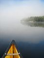 Early morning fog begins to lift on Burnt Island Lake.
 -
 A Moose Dines on Lily Pads
 -
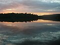
 Morning Twilight
 -
 No water on the Amable du Fond River in August.
 -
 Portaging Canoes
 -
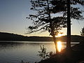 Algonquin Sunset
 -
 Algonquin Sunset
 -
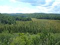 A view of a valley
 -
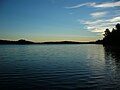
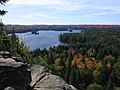 Lookout over Cache Lake


