
Azad Kashmir
The State of Azad Jammu and Kashmir (Urdu: اسلامی جمھوریۃ آزاد کشمیر), usually shortened to Azad Kashmir ('free Kashmir'), is part of the Pakistani-administered section of the Kashmir region, along with the Northern Areas; its official name is Azad Jammu and Kashmir. It covers an area of 13,297 km² (5,134 mi²), with its capital at Muzaffarabad, and has an estimated population of about 4 million.
Azad Kashmir has been considered politically, constitutionally and geographically as part of a separate state, i.e. Jammu & Kashmir. This state is disputed territory, and has been controlled by both Pakistan and India since their independence, 14 / 15 August 1947 respectively. Azad Kashmir is under the indirect control of Pakistan. Its defence, foreign policy and currency are under the direct control of Pakistan.
Consequently, financial matters, i.e. budget and tax affairs, have been dealt with by the Azad Jammu & Kashmir Council, instead of the Central Board of Revenue. Azad Jammu & Kashmir Council is a supreme body consisting of 11 members, 6 from the Government of Azad Jummu & Kashmir, and 5 from the Government of Pakistan. Also its chairman / chief executive is always the President of Pakistan. Hence, the rest of members are Azad Kashmir's own Prime Minister and President and some ministers, (also note that Azad Kashmir has its own "president", "prime minister" and legislative assembly, also supreme-court and high-court & other departments). The Central Board of Revenue (CBR) is responsible for the tax affairs of the rest of Pakistani territory, i.e. all four provinces and the capital, Islamabad.
History
After the partition of India in 1947, the Maharaja of Jammu and Kashmir (see Kashmir region) wanted to maintain the status quo. The only way to achieve this was to remain an independent state. But both India and Pakistan wanted to claim the state of Jammu and Kashmir. With the Maharaja delaying a decision, a revolt broke out in the high lands of Chitral and Skardu and the rebellion spread to involve allied tribesmen from the NWFP. Fearing the defeat of the overwhelmed Kashmir State Forces, the Hindu Maharaja sought military help from India and in turn agreed to accede to India. An Indian defense of the state provoked a response from Pakistan, and signalled the start of Indo-Pakistani War of 1947.
However, the outcome of the war was not decisive, and a ceasefire was called in 1948. The UN Resolutions passed after the ceasefire called for a plebiscite to let the people decide the issue. However, despite Pakistan's repeated calls to hold a plebiscite under UN observation, the dispute has not yet been solved and Kashmir has been divided between India and Pakistan along the Ceasefire Line or the Line of Control ever since.
The western portion of Kashmir was subsequently divided into the following regions by Pakistan:-
- Azad Kashmir - The narrow southern part - 250 miles (400 km) in length with the width varying from 10 to 40 miles (15 to 65 km)
- Northern Areas - A much larger area, 72,496 km² (27,991 mi² ), incorporated into Pakistan and administered as a de facto dependency
- Trans-Karakoram Tract - A small region at the northern frontier of Gilgit-Baltistan agency, ceded to the People's Republic of China in 1963.
Government
Pakistan Administered Kashmir is nominally autonomous, with its own elected President, Prime Minister, Legislature, and High Court. The state is divided into two administrative divisions which in turn are composed of eight districts.
| Division | District | Area (km²) | Pop.(1998) | Headquarter |
|---|---|---|---|---|
| Mirpur | Bhimber | 1,516 | 301,633 | Bhimber |
| Kotli | 1,862 | 563,094 | Kotli | |
| Mirpur | 1,010 | 333,482 | Mirpur | |
| Muzaffarabad | Bagh | 1,368 | 393,415 | Bagh |
| Muzaffarabad | 2,496 | 638,973 | Muzaffarabad | |
| Neelum[1] | 3,621 | 106,778 | Athmuqam | |
| Poonch | 855 | 411,035 | Rawalakot | |
| Sudhnati | 569 | 334,091 | Pallandari | |
| Azad Kashmir | 8 districts | 13,297 | 2,972,501 | Muzaffarabad |
Demographics
A proper census has not been taken in recent years, however the population of Azad Kashmir includes the following tribes:
Like the rest of Pakistan, Azad Kashmir is predominantly Muslim, with minority groups like the Kalash who practice pagan rituals.
Languages
The dominant language of Azad Kashmir is Northern Hindko which is sometimes incorrectly called 'Mirpuri'. Its linguistic boundaries extend beyond the borders of Azad Kashmir and thus it is inaccurate to call it Mirpuri. The Hindko dialects spoken in Azad Kashmir are both distantly related to Punjabi, but have distinct features. Pashto is also spoken by sizeable minority due to a large number of migrants from Afghanistan and Pashto-speaking areas within Pakistan who have settled in the Mirpur area.
Geography
Azad Kashmir is cold and mountainous in the North whilst(see www.kashmir.kct-uk.org) it has a hot and subtropical climate in the southern Mirpur regions. It also boasts some of Pakistan's most scenic mountains and river valleys. The region includes a significant part of the Himalayas, but does not include Nanga Parbat, the world's seventh highest mountain peak, which is in the "Northern Areas".
This section needs expansion. You can help by making an edit requestadding to it . |
Economy
In late 2006, billions of dollars were mooted for development by international aid for the reconstruction and rehabilitation of earthquake-hit zones in Azad Kashmir, though much of it has been lost in bureaucratic channels, leading to delay in help reaching the most needy, but hundred of peoples are till in tents.[1] A land use plan for Muzaffarabad city had been prepared by the Japan International Cooperation Agency.
Gallery
-
LasDana-HajiPir Road Bagh AJ&K
-
Sheru Dhara, Bagh AJK
-
Toli pir 1
-
Toli pir 2
-
Toli pir 3
-
Banjosa Rawalakot
-
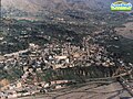
 Kotli Azad Kashmir
 -
 Kotli District Azad Kashmir
 -
 Mangla Dam, next to Mirpur City, Azad Kashmir
 -
Village in Sarsawa Valley, Azad Kashmir
-
Toli pir 4
-
 Typical Homes in Mirpur
 -
Toli pir 5
-
Toli pir 6
-
Toli pir 7
-
Toli pir 8
-
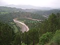
Rawalakot Valley
-
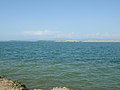
Banjosa Rest House and Lake
-
Rawalakot Bazaar
-
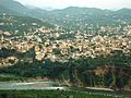
 Bagh City View


See also
- Kashmiriyat - a socio-cultural ethos of religious harmony and Kashmiri consciousness.
- 2005 Kashmir earthquake
- Indian Kashmir barrier
- Kashmir conflict
- Timeline of the Kashmir conflict
- Indo-Pakistan Wars
- Line of Control Kashmir
- Pakistan-administered Kashmir
- Kargil War or the Indo-Pakistani War of 1999
- Trans-Karakoram Tract an area of Kashmir administered by China.
- Aksai Chin an area of Kashmir administered by China.
- List of topics on the land and the people of “Jammu and Kashmir”
- Rajoa
References
- ^ Official website, Government of Azad Kashmir. ""Facts and Figures"". Retrieved 2006-04-19. - Neelum is a recently created district and no figures are available yet.
External links
- Official website of the Government of Azad Kashmir
- Official Azad Kashmir tourism site
- Azad Kashmir Photo Collection
- Pbase photo gallery, taken by Gharib Hanif
- Information on Azad Jammu Kashmir
- Azad kashmir is online now
- Conflict in Kashmir: Selected Internet Resources by the Library, University of California, Berkeley, USA; Library Bibliographies and Web-Bibliographies list