
Auchentiber
The hamlet of Auchentiber is in North Ayrshire, Parish of Kilwinning, Scotland. Auchentiber is 4 miles NE of Kilwinning, 2.2 miles from the hamlet of Burnhouse and 2.6 miles from the village of Barrmill. Grid Ref. NS3647. Some new housing has been built, but the settlement is still very much a hamlet. The settlement is on the Lugton Water, which runs into the River Garnock after running through the Eglinton Country Park in Irvine.
Introduction
Auchentiber lies on the old toll roads from Ayr (15 miles) to Glasgow (17 miles), and Irvine to Glasgow with a junction for Kilwinning and a nearby country road leading to Bloak, Aiket castle, Bonshaw, the Kilbrides and ultimately to Stewarton. The main part of the village is now on a 'cul de sac', however previously lanes, footpaths and fords gave through routes to Fergushill Hall, the Stewarton road and back up to the Glasgow or 'Lochlibo Road' via Bentfauld farm. A lane branches off at Bloak Road Bridge which runs via several farms, past Clonbeith and thence to Irvine via Sevenacres.
History
Spelt 'Auchintibber' in 1879, Ainslie's[1] map of 1822 marks the site of the settlement with the modern spelling of 'Auchentiber'. The name 'Achertybry' is marked on Pont's map of 1604,[2] and another similar name, Achyntybers' is marked in the Parish of Stewarton as part of the 'Barony of Balgray'. The Stewarton area farms of this name are still extant and Pont states that the 'Achin-Tybers' are the inheritance of the Earls of Cassillis.[3] Armstrong's map of 1775,[4] shows Auchentiber, Wardlaw and Redwells. Bloak is spelt 'Bloate'.
| Etymology |
| The name Auchentiber, is thought to be derived, according to Pont,[2] from 'the field of the well'. In Gaelic an 'Achin' is a 'fauld' or 'field' created from the clearance of 'wild' land and a 'Tiber' is a well or spring. See Knockentiber. |
In 1550 , Gavin Hamilton of Raploch, Abbot of Kilwinning Abbey granted the lands of 'Auchintiber' and 'Airthmaid' (Auchenmmade) to Gavin of Raploch, at an annual rent of 16 bolls of beir[5] ('Beir', 'Bere' also 'Bear' was the primitive indigenous form of one-sided barley. It gave a good yield on poor soils and its straw, used for thatching, was long and strong), 9 score 18 stones of cheese, and 7 stirks. This continued with Alexander Cunninghame, the commendator of the abbey in 1571 and third son of Alexander, fifth Earl of Glencairn. He was destined to be shot at his own gate on 1 August 1591 by Sir Robert Montgomerie of Skelmorlie, as part of the reprisals linked to the murder of the Earl of Eglinton, a Montgomery, at the Annick Ford on 18 April 1586.[6]
In June 1590, Andrew Mure is recorded as being the heir to his late father John, in the 10s (Scots) lands of Over-Auchentiber in the Bailiary of Cuninghame, which he holds for the payment of 10 firlots and 2 pecks of oatmeal from the feudal lord. John Dene or Deyne[7] is recorded on the same date as heir to his father John of the 20s (Scots) lands of Over-Auchentiber for 41 stone of cheese (petrae casei). On 4 October 1671, Janet and Agnes Murchland, are recorded as heirs of their grandfather, John Murchland in Cavan Miln (mill), in a part of the 40s (Scots) of Nether - Auchentiber.[7]
In 1640 Hew Montgomerie is recorded as owning 'Over-Auchentyber', with John Dean and his mother, Andro (Sic) Mure and Robert Mure residing there.[7] In 1876 the Auchentibers belonged to Robert Bruce Robertson Glasgow of Montgreenan, William Gemmell, Hugh Fleming, and Robert Fleming.[7]
Steven[8] lists John & Alexander Ferguson, Alexander Wylie and Robert Duncan in 1842 as owners of the 'Auchentibers'.
The Cleikum Inn
An Inn with this name is marked on the 1860 OS map on the right hand side of the road near Bentfauld farm. The 1895 does not name it as an inn, but does mark the inn at the position of the present day Blair Tavern; the 1925 OS marks the inn, but not the present day 'Blair Tavern'. The name Cleikum[9] may be related to the 'Cleikum Inn' which features in Sir Walter Scott’s novel 'St Ronan’s Well', in which the 'Cleikum Club' met in the 'Cleikum Inn', so called from the sign-post showing the Saint catching the Devil. Meg Dods, landlady of the Cleikum Inn, is a formidable hostess, who runs a well organised hostelry with high standards of cleanliness and a distinct partiality regarding the social standing of her guests. This may explain why the name was taken up by many inns throughout the country. The name is derived from a unique ceremony the “Cleikum Celebrations.” . . . According to the ancient story, St Ronan met the evil one and “cleekit him” well and truly by the “hint leg” and vanquished him with the only weapon to hand, the Cleikum Crook, a replica of which is carried by the “Patron Saint” during these celebrations at Innerleithen, near Edinburgh. A boy takes the part of the Patron Saint. A 'Cleik' in Scots is a metal pole from which a pot was hung to heat over a fire.
Mistress Dods[10] was the landlady of the Cleikum Inn near Peebles which hosted the gatherings of the Cleikum Club. The aim of the club, which counted Sir Walter Scott among its members, was to celebrate our National Literature. They certainly were among the first organisations to celebrate a Burns' Night. Mistress Dods was a superb cook and rigorous task-master. Staff ' and guests ' trembled before her! Her major publication 'The Cook's and Housewife's Manual' had the same iconic relationship to Scottish cuisine as that of Mrs Beaton to households south of the border. The name of the inn may reflect the popularity of Sir Walter Scott's novels at the time. The inn may have lost out to competition from the 'Blair Tavern'.
James Samuel Wyper was born on 24th October, 1920, at Shettleston in Glasgow. When he was two years old he moved with his parents to rural Auchentiber near Kilwinning in Ayrshire where their home was a former old coaching inn, the iron rings for tethering horses still embedded in the outer walls.[11] This is likely to be the Cleikum Inn, the site of which has been made into a lay-by in 2006.
The local schools
In 1860 a school is shown on the OS map in the hamlet itself, but by 1879 it has moved to the other side of the Lugton Water, with accommodation for 110 children, and an average attendance of 50, with a grant of £45 11s 0d. In 1881 the attendance was 73 pupils.[12]. A new Auchentiber school was built near the Bloak Road bridge and closed in the late 1960s. The building survives as a private house.
The Blair Tavern
The 'Blair Tavern' is a prominent group of buildings, but it was not opened as a public house until the late 20th century, although the buildings are marked on the 1860 OS map and may be even older. The date 1834 in Roman numerals is above the entrance door of the tavern. In the 1960s it was a garage, the Blair Garage and prior to that it may have had some link with the Fergushill Hall.
Local names
The main road through the hamlet was not in existence in 1745, but when built it is recorded as 'Lochlibo Road'. 'Bloak Road Bridge' is the one near the entrance to Greenlea (previously Greenlee). Mosside was the farm near the Glasgow 20 miles and Irvine 5.25 milestone, now a ruin. Meg'swa's' is Megswells is on the road to Irvine via Clonbeith, mentioned in the 'Lady in the Peat' story. 'Todholes' was a ruin even in 1860 and lay close to small quarried on the Auchentiber moss side of the Kilwinning Road. 'Waukmill' was a building near the ford off the old lane that came out on to the Stewarton road beyond Wardlaw farm.
Fergushill Hall
A number of properties in the surrounding area have the appellation Fergushill, such as at Knockentiber; North & South Fergushills near Eglinton, also Hill and Hall of Fergushill at Auchentiber. A lane ran to Fergushill Hall from the buildings in Auchentiber which now form the Blair Tavern. This lane only exists in part now (2007).
Mineral waters and the Bloak well
Paterson[13] (1866) states that there is a mineral spring near Stewarton, called the Bloak Well. Robinson[14] gives the Scot's word 'blout' as meaning the 'eruption of fluid' or a place that is soft or wet. Both meanings would fit in this context. Blout and Bloak are very similar words, with Bloak Moss lying nearby.
| Etymology |
| The name Auchenmade (previously Achin-Medds), is thought to be derived, according to Pont,[15] from either 'the field of sticks or timber'. In Gaelic this is Achadh-na-maid. Madadh is a wolf, dog or fox and this is another possibility. |
A well recorded as Bloak Well was first discovered in 1800,[16] around 1826[13] or 1810 [17], by the fact that pigeons from neighbouring parishes flocked here to drink. Mr. Cunningham of Lainshaw built a handsome house over the well in 1833[8] and appointed a keeper to take care of it as the mineral water was of some value. This is now known at 'Salt Well', lying next to the Glazert.
The Quarries and limekilns
Near Waukmill the 1860 OS shows whinstone, limestone and sandstone quarries and a limekiln. On the Kilwinning road is marked the Ward whinstone quarry. On the lane down to East Auchenmade are other freestone and limestone qaurries and limekilns. Another whinstone quarry and limekiln was on the road up to Wardlaw. Waukmill no longer exists A weir existed on the Lugton Water nearby and this may have been connected with a waulkmill, one that treated wool to make it suitable for producing cloth for clothing.
The Mosses
This low lying area is dominate by Bloak, Lissens, Sidehead, Kennox, Auchentiber, Dykeneuk and Cockinhead mosses or more correctly 'Raised Bogs'.[18] Cockinhead is unusually well preserved and is a Site of Special Scientific Interest (SSSI), protected by the Scottish Natural Heritage (SNH) organisation. Burns from some of these (Auchentiber and Sidehead) run through the hamlet on their way to join the Lugton Water.
The Railway
Auchenmade railway station was nearby and was originally part of the Lanarkshire and Ayrshire Railway. It opened on 3 September 1888. It closed between 1 January 1917 and 2 March 1919 due to wartime economy, and closed permanently on 4 July 1932.
The Turnpike
Auchentiber was on a toll road or turnpike; the nearest milestone being at the crossroads and the nearest tolls were at Torranyard and Lugton. The name 'Turnpike' originated from the original 'gate' used being just a simple wooden bar attached at one end to a hinge on the supporting post. The hinge allowed it to 'open' or 'turn' This bar looked like the 'pike' used as a weapon in the army at that time and therefore we get 'turnpike'. The term was also used by the military for barriers set up on roads specifically to prevent the passage of horses. In addition to providing better surfaces and more direct routes, the turnpikes settled the confusion of the different lengths given to miles[19], which varied from 4,854 to nearly 7000 feet. Long miles, short miles, Scotch or Scot's miles (5,928 feet), Irish miles (6,720 feet), etc. all existed. 5280 feet seems to have been an average! Another important point is that when these new toll roads were constructed the Turnpike Trusts went to a great deal of trouble to improve the route of the new road and these changes could be quite considerable as the old roads tended to go from farm to farm, hardly the shortest route. The tolls on roads were abolished in 1878 to be replaced by a road 'assessment', which was taken over by the County Council in 1889.
| Etymology |
| Auchenharvie, according to Pont[20] is derived from the 'Low hill or 'Knoppe' in a field of yellow corn. |
Most milestones are no longer in situ and often the only remaining clue is an otherwise unexplained 'kink' in the line of a hedgerow. The milestones were buried during the Second World War so as not to provide assistance to invading troops, German spies, etc.[21]. This seems to have happened all over Scotland, however Fife was more fortunate than Ayrshire, for the stones were taken into storage and put back in place after the war had finished[22].
Farms
Greenlea, Wardlaw, Redwells, Mid Auchenmade, Sunnyside, Sidehead, and Bentfauld farms are in the immediate area.
The Ghost of Auchentiber
The 'Leddy o'Clumbeith' is a ghost story told by Dr. Duguid[23] circa 1840 in the 1820s. A servant girl from the farm of Clonbeith was making her way to the Blair Tavern to keep a tryst when she fell into a mine shaft, horse and all, and was killed. Others say that her 'lad' killed her and then jumped into the shaft after her. Her ghost haunts the fields around Auchentiber.
The Lady in the peat
Dr. Duguid[23] in around the 1840's records that near Clumbeith (Clonbeith) on the way to 'Meg'swa's' he met Pate Glunch cutting peats. Pate was normally a still, dour man, but on this occasion he was highly animated and took the doctor to see the long dead corpse of a 'bonnie lady' lying in a hole in the peat. She was around 18 to 20 years of age, had rosy cheeks, a sweet smile playing around her lips and blonde hair. Her identity was unknown, but a rumour linked her to the family of the Montgreenan estate.
Auchentiber area Gallery
-
Auchenmade's old railway station -
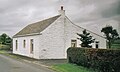
Bloak or Salt Well cottage off the Stewarton Road. -
Auchenharvie Castle in 2007. -
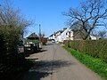
The mainstreet looking towards the main road. -
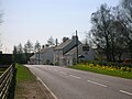
The Blair Tavern on the main road -
The site of the old Cleikum Inn on the main road -
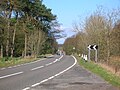
The Lochlibo Road running through Bloak Moss looking towards Auchentiber. -
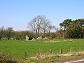
The ruins of the old Mosside farm on the Montgreenan estate near Bloak Moss. -
The ruins of the old Mosside farmhouse. -
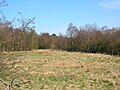
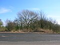
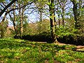
A view of Bloak Moss. -
Auchentiber Moss from the site of the Cleikum Inn -
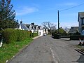
The mainstreet with the site of the old school on the right -
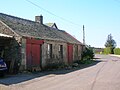
The old Smithy in the mainstreet. -
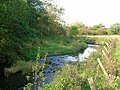
The Lugton Water near the old ford. -
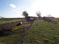
The Old ford across the Lugton Water near the site of the Waulkmill.


The Montgreenan Estate
The first reference to Montgreenan is contained in the description of the ancient county of Cuninghame by Timothy Pont[15] in the period 1604-1608. In it he describes 'Mongrynen Castle' as “…ane old strong Dunijon veil and pleasantly planted ye inheritance of Cuninghame Laird thereof sone to the abott of Kilwinin quho wes brother to James Earle of Glencairne”. The 10 merk[5] land of Montgreenan was held in the 15th century by the Ross family, who had many lands in Ayrshire, such as those of Dunlop and its castle. The Ross's held their lands as vassals of the De Morvilles.
| Etymology |
| Montgreenan means 'Mound of the Sun' according to Smith.[16] |
Following the murder of James III, Sir John Ross de Montgreenan lost all his lands, only to rapidly return to royal favour under the rule of James IV and regain the Manor of Montgreean. The manor is said to have passed to the Monastery of Kilwinning and then to Alexander Cunninghame and his wife Jean Blair in 1582 - 83 following the reformation, of which, Alexander had been a prominent supporter.[24] Lady Jean Cunnighame died in 1621, leaving the lands to her son William, and by 1632 Alexander Cuninghame, a grandson of Lady Jean was the owner, succeeded by his son Thomas in 1656. Thomas's son, of the same name, fought at the Battle of Bothwell Bridge and was sentenced to death for his actions. His life was spared, however his lands were forfeited and given to Lieutenant-General Douglas who sold it on to High Stevenson, clerk to the Privy Council. The estate remained with the Stevenson's until 1778, when they sold it to John Bowman of Ashinyards, who in turn sold it to Dr. Robert Glasgow. The doctor married a daughter, Rachel, of John Dunlop of that Ilk, but they had no offspring and died in 1827. The funeral was famous for the generosity shown to 616 poor people of the parish.
Mrs. Rachel Glasgow was an authoress with great literary taste and she died at Pau, in the Pyrenees, on 19 July 1828. Robert Robertson of Prenderguest, a son-in-law, inherited the estate, changing his surname to 'Glasgow'. Robert Roberton Glasgow, his son, inherited in 1845 and in 1860 his son, Robert Bruce Robertson Glasgow inherited Montgreenan in his turn.[25]
The Castle or Bishop's Palace
The ruins of the old Montgreenan Castle or Bishop's Palace lie in a loop of the Lugton Water at the its confluence with the Cowlinn Burn. The name Dunach Brae for the strip of woodlands nearby, suggests that a hillfort or 'Dun'[26] may have been in the vicinity at a much earlier date. Alexander Cunninghame, the Commendator[5] of Kilwinning Abbey, was shot at his gate at Montgreenan by Sir Robert Montgomerie of Skelmorlie in 1591, as a direct result of the assassination of the Fourth Earl of Eglinton at Stewarton a few years before. A pair of ancient gateposts still stands in the woods behind the hotel. It seems likely that the Abbot had a house in what now constitutes the field between the hotel and the gateposts. The pillars at the entrance to the hotel appear to be from an earlier building but no other trace of the earlier house remains.
Contradicting the previous statements, John Smith in 1895 recorded that in the Montgreenan Woods are the remains of a Bishop's Palace, sometimes called a castle, of which little appears to be known. Not far away is part of an ancient gateway, and just S of the house there are the remains of a mound which once contained an ice-house. All that remains at this site is a small piece of wall at the side of the stream, and a slight hollow, partly surrounded by a bank formed by the rubbish of the old walls. Mr R Glasgow, the proprietor, stated in the 1856 Name Book of the ordnance Survey that it probably became disused in 1680, when the last Cunninghame of Montgreenan was forfeited. Its remains were removed about 1765 by the previous proprietor, Mr Stevenson, to build a house at Kilwinning.[27]
A visit in 1956 recorded that in the thick vegetation were traces of buildings, enclosed by a wall on W and S. The details are unclear, but the castle plan seems to be that of a courtyard with internal buildings on all sides except perhaps the E, where there is a wall running along the edge of the Lugton Water. Such a building design with a central courtyard was called a 'Place' or 'Palace'. All the walls were merely heaps of rubble, and the drystone "courtyard" wall seemed to be of later construction than the internal remains, acting as a revetment to the mass of rubble inside. This wall was 1.4m high. No evidence was encountered for this being a "Bishop's Palace". About 65.0m to the S was a mound, 1.5m high, which had been cut through by a track, and may be the ice-house referred to by Smith, although no stone-work exists. No trace of a gateway was found, although the possible entrance shown on OS plan may be the gateway referred to.[28]
The Mansion House
The present Mansion House was built by Sir Robert Glasgow in 1817. Sir Robert, in common with other entrepreneurs from the Glasgow area, made his fortune through a shipping company based in St Vincent in the West Indies, undoubtedly trading between Britain, Africa and the sugar plantations of the West Indies. Montgreenan mansion house was a private dwelling until 1982, since when it has been a hotel.[29] The building is Category A listed by Historic Scotland.
The Montgreenan house to Auchentiber carriageway
The 1858 OS map shows a carriage or driveway running from near the surviving Auchentiber schoolhouse through the Montgreenan plantations towards
Natural History
The Old Wood in particular has a high biodiversity, some of the species noted in 2007 being Woodruff, Bird cherry, Primrose, Common violet, Oak, Stitchwort, Opposite-leaved Golden saxifrage, Bluebell, Dog's mercury, Broad buckler fern, Lord and Ladies, Lady fern, Male shield fern, Easter ledges, Wood-rush, Wood-sedge, blackthorn, hawthorn, elm, alder, Wood anemone, Wood sorrel, Wood avens, Herb Robert, Red campion, and many liverworts.
Montgreenan Gallery 2007
-
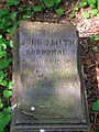
A memorial stone to Corporal John Smith at Montgreenan old castle. -
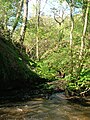
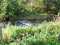
The Cowlinn Burn from Clonbeith joining the Lugton Water at Montgreenan Castle -
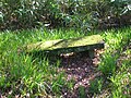
A seat near the old castle at an old entrance gate -
A possible entrance way into the old castle. -
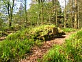
Possibly Victorian walling around the outside of the old castle. -
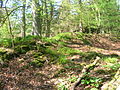
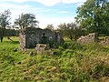
An inside view of the old castle -
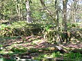
A view of the outside wall of the old castle. -
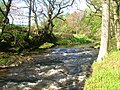
A dike on the Lugton Water near old Montgreenan castle


Miscellaneous

In 1507 a nominal fine is next inflicted on a Cuthbert Rotisoune,[30] farmer in Auchentiber, for an assault committed on one of his neighbours and upon the son. The latter he had cast into the fire, burning him severely. Fine, five merks.
The old estate of Montgreenan is now a hotel, about 1.2 miles away towards Torranyard.
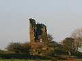
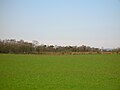
The ruin of Auchenharvie Castle is a prominent feature of this flat landscape in the Torranyard area.

Beside the driveway running to the Montgreenan mansion house from the West Lodge are a couple of milestones. They look like gatepost-like and appear to have been 'rescued' after they became redundant or 'in the way' as a result of road widening works, etc.
A smithy is marked on the 1860 OS map on the 'hamlet' side of the crossroads and the relatively unchanged building is still present today (2007). The site of the old hamlet school is now occupied by modern buildings.
Pencot community woodland lies between Auchentiber and Dalry. The trees have grown a fair bit now (2007) and the place has now evolved into a fine location for a walk in the country. Park at N55,42.299 W004, 39.835 and chose one of the three alternative paths. It doesn't matter which one, as they will all take you there in the end. The middle path will take you via the trig point.
Bloak Moss[18] has been scientifically investigated to ascertain its vegetational history through the analysis of core samples.
Steven[8] states that a 'village' called Bloak with about twelve families existed in 1842, with its own school. It was near the Bloak or salt well.
A few springs or 'tibers' are still visible as the source of small burns running into the Glazert beyond Wardlaw farm.
References and Bibliography
- ^ Ainslie, John (1821). A Map of the Southern Part of Scotland.
- ^ a b Pont, Timothy (1604). Cuninghamia. Pub. Blaeu in 1654.
- ^ Dobie, James D. (ed Dobie, J.S.) (1876). Cunninghame, Topographized by Timothy Pont 1604-1608, with continuations and illustrative notices. Pub. John Tweed, Glasgow. P. 50.
- ^ Armstrong and Son. Engraved by S.Pyle (1775). A New Map of Ayr Shire comprehending Kyle, Cunningham and Carrick.
- ^ a b c Local History Dictionary Cite error: The named reference "Local" was defined multiple times with different content (see the help page).
- ^ Dobie, James D. (ed Dobie, J.S.) (1876). Cunninghame, Topographized by Timothy Pont 1604-1608, with continuations and illustrative notices. Pub. John Tweed, Glasgow. P. 265.
- ^ a b c d Dobie, James D. (ed Dobie, J.S.) (1876). Cunninghame, Topographized by Timothy Pont 1604-1608, with continuations and illustrative notices. Pub. John Tweed, Glasgow. P. 51. Cite error: The named reference "Dobie51" was defined multiple times with different content (see the help page).
- ^ a b c Steven, Rev. Charles Bannatyne (Revised 1842). Parish of Stewarton. Presbytery Of Irvine, Synod of Glasgow and Ayr
- ^ Scots Dictionary
- ^ The Cleikum Club
- ^ 'The Northern Times' 6 April 2007.
- ^ Groome, Francis H. (1880-85) Ordnance Gazetteer of Scotland: A Survey of Scottish Topography, Statistical, Biographical and Historical, published in parts by Thomas C. Jack, Grange Publishing Works, Edinburgh.
- ^ a b Paterson, James (1863-66). History of the Counties of Ayr and Wigton. V. - III - Cunninghame. J. Stillie. Edinburgh.
- ^ Robinson, Mairi (2000). The Concise Scots Dictionary. Aberdeen. ISBN 1902930002
- ^ a b Pont, Timothy (1604). Cuninghamia. Pub. Blaeu in 1654. P. 50
- ^ a b Smith, John (1895). Prehistoric Man in Ayrshire. Pub. Elliot Stock. Cite error: The named reference "Smith" was defined multiple times with different content (see the help page).
- ^ Topographical Dictionary of Scotland (1846). P. 467
- ^ a b Raised Bogs Cite error: The named reference "Raised Bogs" was defined multiple times with different content (see the help page).
- ^ Thomson, John (1828). A Map of the Northern Part of Ayrshire.
- ^ Pont, Timothy (1604). Cuninghamia. Pub. Blaeu in 1654. P. 51.
- ^ Wilson, Jenny (2006). Oral communication with Griffith, R.S.Ll.
- ^ Stephen, Walter M. (1967-68). Milestones and Wayside Markers in Fife. Proc Soc Antiq Scot, V.100. P. 184.
- ^ a b Service, John (Editor) (1887). The Life & Recollections of Doctor Duguid of Kilwinning. Pub. Young J. Pentland. Cite error: The named reference "Service" was defined multiple times with different content (see the help page).
- ^ Dobie, James D. (ed Dobie, J.S.) (1876). Cunninghame, Topographized by Timothy Pont 1604-1608, with continuations and illustrative notices. Pub. John Tweed, Glasgow. P. 333 - 338.
- ^ Dobie, James D. (ed Dobie, J.S.) (1876). Cunninghame, Topographized by Timothy Pont 1604-1608, with continuations and illustrative notices. Pub. John Tweed, Glasgow. P. 333 - 338.
- ^ Warrack, Alexander (1982)."Chambers Scots Dictionary". Chambers. ISBN 0-550-11801-2.
- ^ "The RCAHMS's Canmore Website". Retrieved 2007-04-27.
- ^ "The RCAHMS's Canmore Website". Retrieved 2007-04-27.
- ^ - Montgreenan Hotel
- ^ Trials of the Feudalists