
Manitoba Highway 1
 Provincial Trunk Highway 1 | |
|---|---|
| Trans-Canada Highway | |
| Route information | |
| Maintained by Department of Infrastructure | |
| Length | 519 km (322 mi) |
| Existed | 1942–present |
| Major junctions | |
| West end | |
| East end | |
| Location | |
| Country | Canada |
| Highway system | |
|
| |
Provincial Trunk Highway 1 (PTH 1) is the Manitoba section of the Trans-Canada Highway mainline route. The total distance of the Trans-Canada Highway in Manitoba is 519 km (322 miles). It is a heavily used, 4-lane divided highway, with the exception of a short 18km section in the southeastern corner of the province which is a 2-lane highway. It is the main link between southern Manitoba's largest cities, and also serves as the province's main ground transportation link to the neighboring provinces of Saskatchewan (to the west) and Ontario (to the east). The highway is the only major east-west divided highway in Manitoba, and carries a large majority of east-west traffic within the province. It has full freeway status sections in Portage La Prairie and Winnipeg.
Manitoba Highway 1 is a very important part of the national highway system in Canada, as it is the sole highway linking the eastern and western regions of the country. It is the only highway that links the province of Manitoba with the province of Ontario, making it a major section of Canada's primary commercial and leisure route for all traffic travelling between Canada's largest cities, from Toronto and Montreal in the east to Calgary and Vancouver in the west.
Routing

The highway is routed from west to east across the province of Manitoba. It begins at the western provincial border with Saskatchewan, connecting with Saskatchewan's Highway 1 to become Manitoba PTH 1. The highway is designated as PTH 1 throughout Manitoba until it reaches the eastern provincial border with Ontario, where it continues as the main route to Kenora, Ontario and the rest of Eastern Canada as Highway 17.
The entire length of the Trans-Canada Highway in the province of Manitoba is a 4-lane divided highway, with the exception of the Winnipeg city route and an 18 kilometer (11 mile) section in eastern Manitoba between the town of Falcon Lake and the Manitoba-Ontario provincial border which is a two-lane highway.
Manitoba PTH 1 has full freeway status on sections around Winnipeg on the Perimeter Highway & Portage La Prairie. Plans do exist to bring the entire length of Highway 1 (except the Winnipeg city route) to full freeway status in the future. Currently, exit numbers only exist at two interchanges; the Highway 12 interchange being the first numbered outside of the Winnipeg area.
In the Winnipeg metro area, the Trans-Canada Highway has two official routes. The main route passes directly through the city of Winnipeg on city streets, entering the city from the west and continuing along Portage Avenue, Broadway, Main Street, Queen Elizabeth Way, St.Mary's Road, St.Anne's Road, and Fermor Avenue where it re-joins the Perimeter Highway (PTH 100) and continues east on PTH 1. An alternate routing exits the main PTH 1 route on the western edge of Winnipeg onto the Perimeter Highway (PTH 100), which by-passes the city completely. The Perimeter Highway is a beltway which encircles Winnipeg and is frequently used by commuters and through traffic on the Trans Canada Highway wishing to avoid congested city streets.
History
The first provincial trunk highways in Manitoba were numbered in 1926. [1] The original highway 1 was one of nine highways fanning out from Winnipeg, but was different in that it fanned out from the west and the east. Highway 1 was routed via many already-existing highways. (From west to east), these are [2][3][4]:
- Highway 1A into and out of Brandon
- Highway 1A through Portage la Prairie
- Highway 26 from Portage la Prairie to Headingley
- Highway 59 from downtown Winnipeg to Highway 44
- Highway 44 to Whiteshell, Manitoba
By the early 1950s, Highway 1 had become an important east-west route in all of the western provinces. Most of the provincial highways that Highway 1 originally traversed on were re-numbered and designated as Highway 1 in the mid-1960s, and the #1 was relocated to its present route. In 1962, the Trans-Canada Highway in Manitoba was fully completed, and Highway 1 across all of the western provinces was incorporated as part of the Trans-Canada Highway. [5]
In 1955, most intra-city traffic in the Winnipeg area was diverted onto the (then) newly-built Perimeter Highway. Later that year, the Perimeter Highway's southern (PTH 100) section was merged with the Trans-Canada Highway system, due to the amount of traffic using it to bypass the city. That section of the highway was highly used, and still is today.
Recent History
On October 6, 2006 the Trans-Canada Highway Portage La Prairie by-pass was closed due to a structural defect found in the bridge over the CN Rail Line. On October 31, 2007, a $19 million project to rebuild the bridge was completed, and the by-pass was fully re-opened to traffic.
On October 25, 2007, a major federal/provincial construction project twinning the highway in western Manitoba between the Saskatchewan-Manitoba provincial border and the town of Hargrave was completed, with 34 kilometers (21 miles) of newly divided highway lanes opened to traffic.
On April 9th, 2008, the Government of Manitoba announced that construction of a new interchange will begin in the summer of 2008 at the intersection of Highway 16 (the Yellowhead Highway) and the Trans Canada Highway mainline route, located a short distance west of Portage la Prairie. [6]
Speed limits
On February 27, 2008 the Manitoba Highway Traffic Board approved a request by the Government of Manitoba to raise the speed limit on the Trans Canada Highway in Manitoba to 110km/h along the section between the Saskatchewan-Manitoba border and Winnipeg. A date on which the speed limit will officially be changed has not been set.[7]
Western Manitoba- 100 km/h (60 mph)
Virden- 80 km/h (50 mph)
Brandon- 80 km/h (50 mph)
Portage La Prairie (Freeway)- 100 km/h (60 mph)
Elie- 80 km/h (50 mph)
Winnipeg bypass (Perimeter Hwy. PTH #100) - 100km/h (60 mph)
Winnipeg city route
Portage Ave. - 60 km/h (35 mph) (50 km/h (30 mph) in downtown)
Broadway - 50 km/h (30 mph)
Queen Elizabeth Way. (S. Main Street) - 60 km/h (35 mph)
St. Mary's Rd. - 60 km/h (35 mph)
St. Annes Rd. - 60 km/h (35 mph)
Fermor Ave. (To Lagimodiere Blvd.) - 70 km/h (40 mph)
Fermor Ave. (To Perimeter Hwy.) - 90 km/h (55 mph)
Eastern Manitoba- 100 km/h (60 mph)
All at-grade intersections with traffic lights -80 km/h (50 mph)
Photo gallery
-
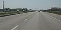
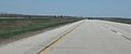 Eastbound in south-central Manitoba near Elie
 -
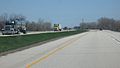 Eastbound heading toward Winnipeg at St. Francois-Xavier
 -
 Heading east, just west of Winnipeg near Headingley
 -
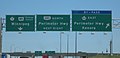 Trans Canada Highway Winnipeg City Route/Winnipeg by-pass route
 -
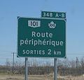 Winnipeg Trans Canada Highway by-pass sign in French
 -
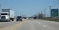
 Traffic on the Winnipeg City Route of the Trans Canada Highway
 -
 Travelling on the Perimeter Highway (Hwy 100), the Trans Canada Hwy Winnipeg bypass route
 -
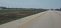 Westbound heading to Winnipeg near Lorrette (East of Winnipeg)


List of exits/intersections
The following is a list of exits/intersections along PTH 1. Only named (in cities and towns only) and numbered highway intersections are included. (In Winnipeg, only major road intersections are included). This list is routed from West to East, starting at the Saskatchewan-Manitoba border to the Manitoba-Ontario border.
This list is incomplete; you can help by adding missing items. |
Saskatchewan-Manitoba Border
Elkhorn
Intersection- PR 256, Cavendish St.
Intersection- Maharg Rd.
Intersection- Richhill Ave.
Intersection- PTH 83 South
Intersection- PR 259 East
Intersection- PTH 83 South
Virden
Intersection- Thomas Dr.
Intersection- PR 259 North, King St.
Intersection- PR 257 West
Intersection- PR 254 South
Intersection- PR 254 North
Intersection- PTH 21
Intersection- PR 250 North
Intersection- PR 250 South
Exit- PTH 1A East
Exit- PR 459 East
Intersection- PR 270 North
Brandon
Intersection- PTH 10 South, 18 St. N.
Intersection- Black St.
Intersection- PTH 1A West, PTH 10 North, 1 St. N.
Intersection- PR 468
Intersection- PR 340 South
Intersection- PR 464 North
Intersection- PR 351 East
Intersection- PTH 5
Intersection- PR 351 West
Intersection- PR 352
Intersection- PTH 34
Intersection- PR 350
Intersection- PR 242
Intersection- PTH 16 West, Yellowhead Highway.; PR 305 South
Portage La Prairie
Exit- PTH 1A East
Exit- PR 240, River Rd.
Exit- PTH 1A West
Intersection- Old PTH 26
Intersection- PTH 13 South, PR 430 North
Intersection- PR 331 West
Intersection- PR 248
Intersection- PR 332 South
Intersection- PR 241
Intersection- PTH 26 West
Headingley
Intersection- PR 334, King St.
Intersection- Hudson St.
Intersection- PR 334 South, Monterey Rd.
Intersection- Lyons St.
Intersection- Simmons Dr.
Intersection- Bresaylor Rd.
Intersection- Cameron St.
Intersection- Inglenook Rd.
Intersection- Camp Manitou Rd.
Intersection- Race Track Rd.
Intersection- (Eastbound) McCarthy St.
Exit- PTH 100 South, Perimeter Highway.
Winnipeg
(Major roads only, as there are many local roads PTH 1 intersects.)
Exit- PTH 101 North, Perimeter Highway.
Intersection- Buchanan Blvd.
Intersection- Cavalier Dr.
Intersection- Westwood Dr.
Intersection- Sturgeon Rd.
See also
References
- ^ "A.C. Emmett and the Development of Manitoba's Highways". The Government of Manitoba. Retrieved 2008-02-03.
- ^ {{Cite web | Title = Official map of Western Canada, 1946 | http://www.ontarioroadmaps.ca/Oil_Companies/Shell/1946/Maps/WCanada.jpg | Publisher = The H.M. Gousha Company | url = http://www.ontarioroadmaps.ca/Oil_Companies/Shell/1946/Maps/WCanada.jpg | accessdate = 2008-02-03
- ^ {{Cite web | Title = Route map of central and west North America, 1938 | Publisher = R. V. Droz url = http://www.geocities.com/rvdroz/us38nw.jpg | accessdate=2008-02-03
- ^ {{Cite web | title = The Atlas of Canada -- Major Roads, 1955 | publisher = The Atlast of Canada | url = http://atlas.nrcan.gc.ca/site/english/maps/archives/3rdedition/economic/transportationandcommunications/085?w=4&h=4&l=2&r=0&c=0 | accessdate = 2008-02-03
- ^ "Numbering and history of highways in Manitoba". Nathan Edgars II. Retrieved 2008-02-03.
- ^ http://www.gov.mb.ca/chc/press/top/2008/04/2008-04-09-164000-3503.html
- ^ http://www.etrucker.com/apps/news/article.asp?id=67017 Manitoba to raise speed limit
