Metropolitan Borough of Paddington
| Paddington | |
|---|---|
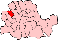
 Paddington within the County of London | |
| Area | |
| • 1911 | 1,356 acres |
| • 1931 | 1,357 acres |
| • 1961 | 1,355 acres |
| Population | |
| • 1911 | 142,551 |
| • 1931 | 144,923 |
| • 1961 | 116,923 |
| Density | |
| • 1911 | 105/acre |
| • 1931 | 107/acre |
| • 1961 | 86/acre |
| History | |
| • Created | 1900 |
| • Abolished | 1965 |
| • Succeeded by | City of Westminster |
| Status | Metropolitan borough |
| Government | Paddington Borough Council |
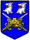
 Coat of arms of the borough council | |
The Metropolitan Borough of Paddington was a metropolitan borough of the County of London between 1900 and 1965.
History

Its area covered that part of the current City of Westminster west of Edgware Road and Maida Vale, and north of Bayswater Road. Places in the borough included Paddington, Westbourne Green, Bayswater, Maida Hill, West Kilburn, Maida Vale. To the south it bordered the Metropolitan Borough of Westminster, to the east, the Metropolitan Borough of St Marylebone.
Paddington Town Hall, designed by James Lockyer in the Classical style, dated from 1853.[1] The building, originally the Vestry Hall, was situated on Paddington Green. It was enlarged in 1900 and 1920. Following its closure in 1965, it was demolished to make way for the Westway urban motorway. The chair used by the Mayors of Paddington at council meetings was preserved, and is currently placed in the hallway at the Council House in Marylebone Road, the current meeting place for Westminster City Council. The war memorial, unveiled in 1924, was moved to the adjacent parish church of St. Mary.[2]
It was abolished in 1965 by the London Government Act 1963 and its former area merged with that of the Metropolitan Borough of Westminster and the Metropolitan Borough of St Marylebone to form the present-day City of Westminster.
Coat of arms
The coat of arms were adopted from the devices on the former Paddington seal, combined with the wolves' heads and blue background of the arms of the first Mayor of the Borough, Sir John Aired. One suggestion is that the wolf heads commemorate the killing of the last wolf in Middlesex in Paddington. The vestry seal had included the cross swords of the See of London.[3] The coat-of-arms was granted 5th April 1902 by the College of Arms, but designs were in use before that date.
Area and population
The area of Paddington Metropolitan Borough was 1,357 acres (5.5 km2), once part of Kensal New Town was added after 1901. The population recorded in the Census was:
Civil Parish 1801-1899
| Year[4] | 1801 | 1811 | 1821 | 1831 | 1841 | 1851 | 1861 | 1871 | 1881 | 1891 |
|---|---|---|---|---|---|---|---|---|---|---|
| Population | 1,881 | 4,609 | 6,476 | 14,540 | 25,173 | 46,305 | 75,784 | 96,813 | 107,058 | 117,846 |
Metropolitan Borough 1900-1961
| Year[5] | 1901 | 1911 | 1921 | 1931 | 1941 | 1951 | 1961 |
|---|---|---|---|---|---|---|---|
| Population | 143,976 | 142,551 | 144,261 | 144,923 | [6] | 125,463 | 116,923 |
- Note that the population statistics up to 1891 exclude the area of Kensal Town transferred from Chelsea in 1900.
Notable places
- Kensal Green Cemetery
- Paddington Station
- St. Mary's Hospital - Dr. Alexander Fleming discovered penicillin here
- City Of Westminster College (formerly Paddington College)
References
- ^ Nikolaus Pevsner, The Buildings of England: London except the Cities of London and Westminster Harmondsworth 1952
- ^ Victoria County History of the County of Middlesex: Volume 9: Hampstead, Paddington (1989)
- ^ Civic Heraldry accessed 15 Jan 2008
- ^ Statistical Abstract for London, 1901 (Vol. IV); Census tables for Metropolitan Borough of Paddington
- ^ Paddington MetB: Census Tables accessed 19 June 2007
- ^ The census was suspended for World War II

