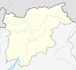
Martell, South Tyrol
Martell | |
|---|---|
| Comune di Martello Gemeinde Martell | |
| Coordinates: 46°33′N 10°47′E / 46.550°N 10.783°E | |
| Country | Italy |
| Region | Trentino-Alto Adige/Südtirol |
| Province | Bolzano-Bozen (BZ) |
| Frazioni | Ganda (Gand), Meiern, Montesole (Sonnenberg), Transacqua (Ennewasser), Val d'Enne (Ennetal) |
| Government | |
| • Mayor | Rag. Peter Gamper |
| Area | |
| • Total | 143.7 km2 (55.5 sq mi) |
| Elevation | 1,312 m (4,304 ft) |
| Population (Dec. 2004)[2] | |
| • Total | 879 |
| • Density | 6.1/km2 (16/sq mi) |
| Demonym(s) | Italian: martellesi German: |
| Time zone | UTC+1 (CET) |
| • Summer (DST) | UTC+2 (CEST) |
| Postal code | 39020 |
| Dialing code | 0473 |
| Website | www.comune.martello.bz.it |
Martell (Italian: Martello; Archaic (1280AD): Murtella) is a comune (municipality) in the province of Bolzano-Bozen in the Italian region Trentino-Alto Adige/Südtirol. It is located in the Val Martello (German: Martelltal) of the 28,5km long river Plima, about 60 km northwest of Trento and about 45 km west of Bolzano. The commune reaches from an elevation of 957m up to the 3757m of Monte Cevedale (German: Zufallspitze) which towers over the southeastern end of the valley.
As of 31 December 2004, it had a population of 879 and an area of 143.7 km².[3]
Apart from the main village of Ganda (Gand), the municipality of Martell contains the frazioni (subdivisions, mainly villages and hamlets) of Meiern, Montesole (Sonnenberg), Transacqua (Ennewasser) and Val d'Enne (Ennetal), as well as several farms and hotels.
Martell borders mainly to the municipality of Latsch at the bottom of the valley. Other neighbors based in the Vinschgau Valley of the Adige are Stilfs, Laas and Schlanders. Ulten is in the neighboring valley to the East, while Peio, Rabbi and Valfurva are to the south.
Demographic evolution

References
- ^ "Superficie di Comuni Province e Regioni italiane al 9 ottobre 2011". Italian National Institute of Statistics. Retrieved 16 March 2019.
- ^ "Popolazione Residente al 1° Gennaio 2018". Italian National Institute of Statistics. Retrieved 16 March 2019.
- ^ All demographics and other statistics: Italian statistical institute Istat.
External links


